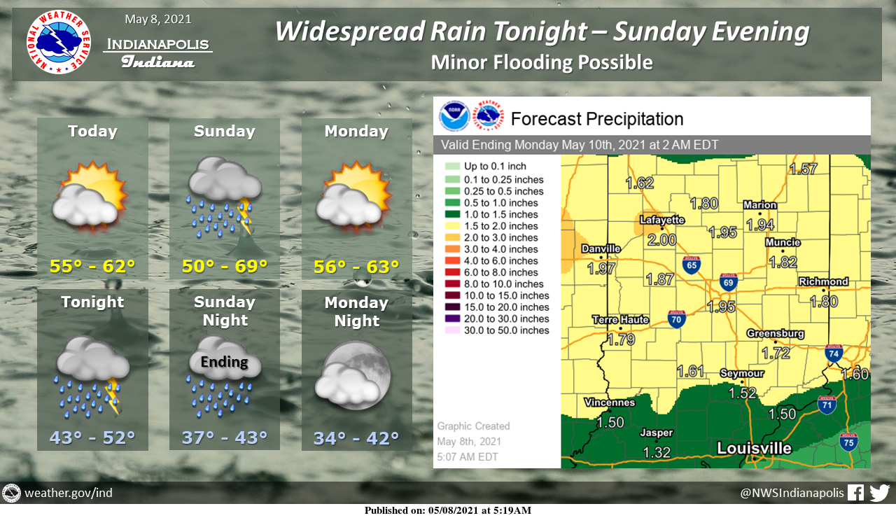
Widespread rain is expected, and a few thunderstorms will be possible from tonight into Sunday evening.
Widespread rainfall amounts of 1-2 inches are expected with isolated higher amounts.
This may cause flooding along area rivers and streams and in poor drainage areas.
INDIANAPOLIS 7-DAY EXTENDED FORECAST
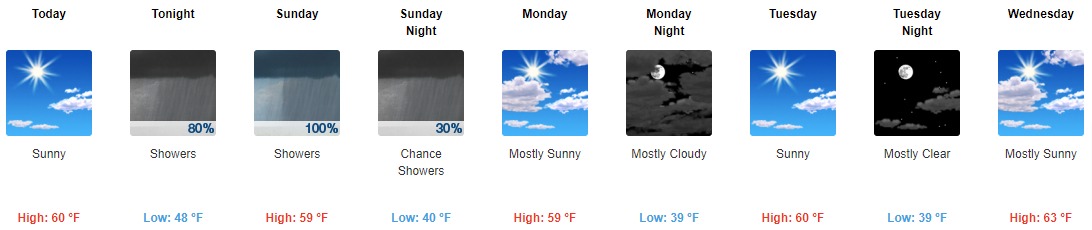
Today: Sunny, with a high near 60. North northeast wind around 5 mph becoming calm in the afternoon.
Tonight: Showers, with thunderstorms also possible after 5 am. Low around 48. Calm wind becoming east 5 to 8 mph after midnight. The chance of precipitation is 80%. New rainfall amounts between a half and three-quarters of an inch possible.
Sunday: Showers and possibly a thunderstorm. High near 59. East wind 10 to 13 mph becoming west southwest in the afternoon. Winds could gust as high as 25 mph. The chance of precipitation is 100%. New rainfall amounts between 1 and 2 inches possible.
Sunday Night: A 30 percent chance of showers before 2 am. Cloudy, then gradually becoming partly cloudy, with a low around 40. North wind 6 to 11 mph, with gusts as high as 21 mph.
Monday: Mostly sunny, with a high near 59. North wind 6 to 9 mph.
Monday Night: Mostly cloudy, with a low around 39.
Tuesday: Sunny, with a high near 60.
Tuesday Night: Mostly clear, with a low around 39.
Wednesday: Mostly sunny, with a high near 63.
Wednesday Night: A 30 percent chance of showers, mainly after 2 am. Mostly cloudy, with a low around 45.
Thursday: A 30 percent chance of showers. Partly sunny, with a high near 64.
Thursday Night: Partly cloudy, with a low around 46.
Friday: A 20 percent chance of showers. Mostly sunny, with a high near 67.
THE UNITED STATES OF AMERICA 3-DAY OUTLOOK


SOURCE: NWS Indianapolis.
Follow NWS Indianapolis on Twitter @NWSIndianapolis for the latest Indianapolis area weather news.