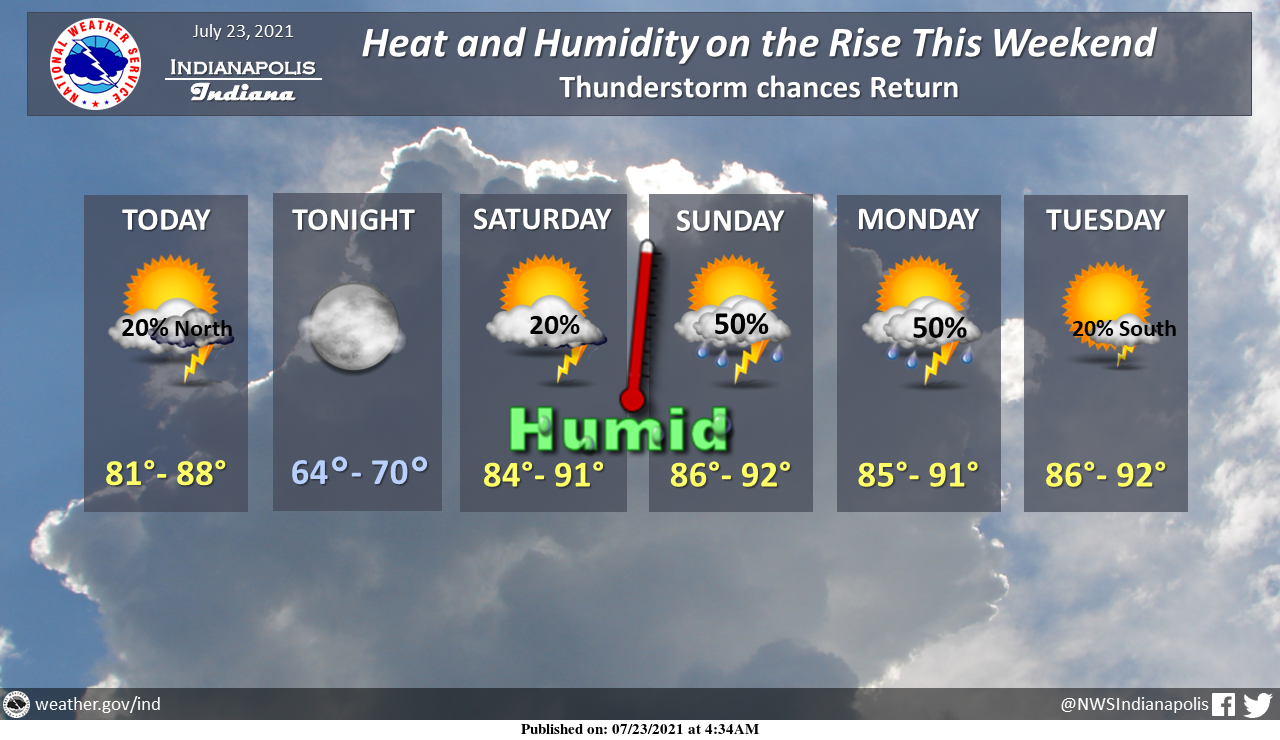
The temperature and humidity will be on the rise this weekend.
Thunderstorm chances will also return.
A few could be strong or severe north of Crawfordsville and Muncie late Saturday afternoon and evening.
DANGEROUS HEAT IN THE WABASH VALLEY
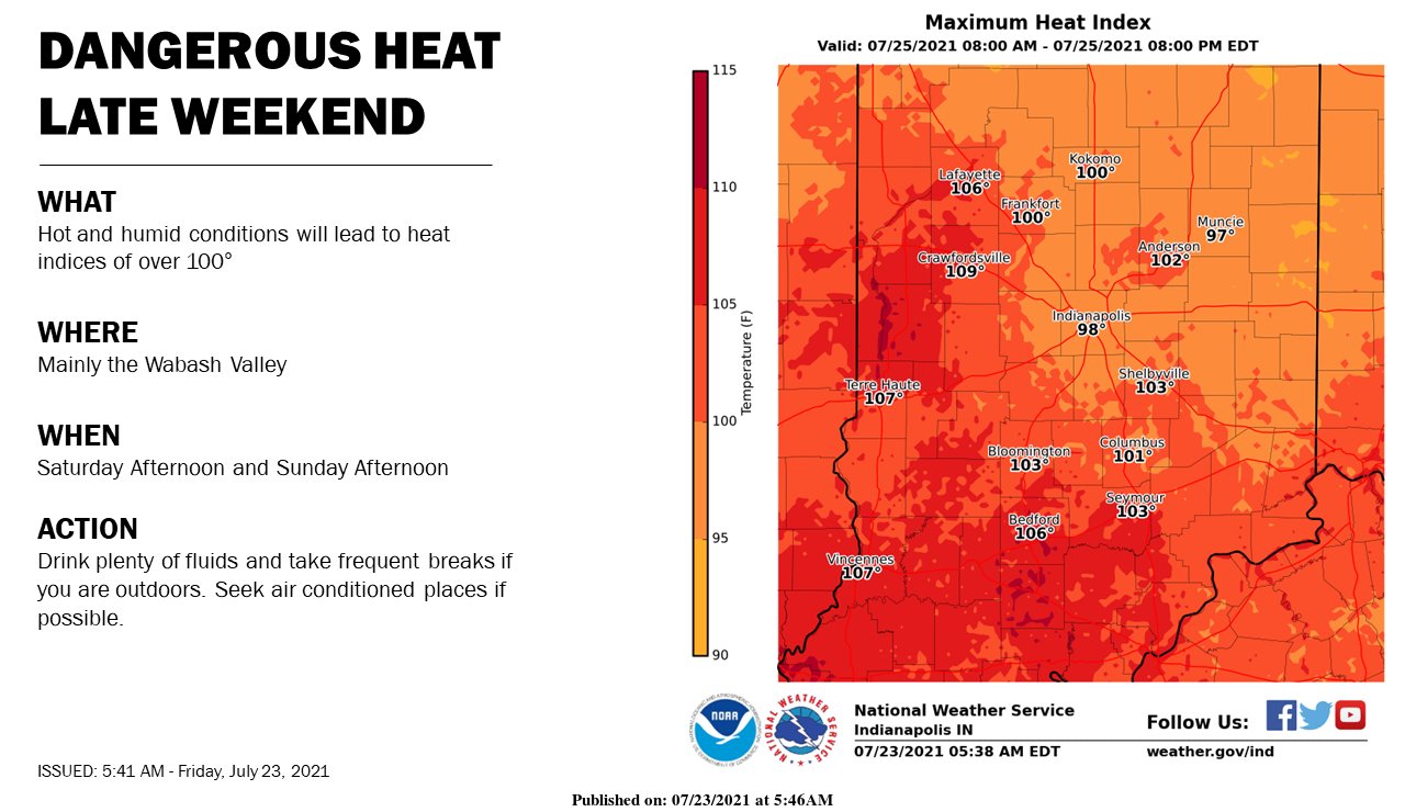
A dangerous combination of heat and humidity Saturday and Sunday Afternoon hours. Wear light colors, limit outdoor exposure, and stay hydrated!
INDIANAPOLIS 7-DAY EXTENDED FORECAST
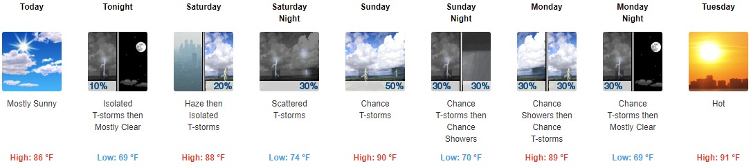
Today: Mostly sunny, with a high near 86. South wind 3 to 6 mph.
Tonight: Isolated showers and thunderstorms before 8pm. Partly cloudy, with a low around 69. South wind 3 to 5 mph. The chance of precipitation is 10%.
Saturday: Isolated showers and thunderstorms after 2pm. Widespread haze after 11am. Mostly sunny, with a high near 88. Southwest wind 5 to 9 mph. The chance of precipitation is 20%.
Saturday Night: Scattered showers and thunderstorms, mainly after 2am. Partly cloudy, with a low around 74. Southwest wind 6 to 8 mph. The chance of precipitation is 30%.
Sunday: A 50 percent chance of showers and thunderstorms, mainly after 2pm. Mostly sunny, with a high near 90. West wind around 6 mph. New rainfall amounts of less than a tenth of an inch, except higher amounts possible in thunderstorms.
Sunday Night: A 30 percent chance of showers and thunderstorms. Partly cloudy, with a low around 70.
Monday: A 30 percent chance of showers and thunderstorms. Mostly sunny, with a high near 89.
Monday Night: A chance of thunderstorms before 8pm. Mostly clear, with a low around 69. The chance of precipitation is 30%.
Tuesday: Sunny and hot, with a high near 91.
Tuesday Night: Mostly clear, with a low around 70.
Wednesday: Sunny and hot, with a high near 91.
Wednesday Night: Mostly clear, with a low around 70.
Thursday: A 20 percent chance of showers and thunderstorms. Mostly sunny and hot, with a high near 91.
THE UNITED STATES OF AMERICA 3-DAY OUTLOOK


SOURCE: NWS Indianapolis.
Follow NWS Indianapolis on Twitter @NWSIndianapolis for the latest Indianapolis area weather news.