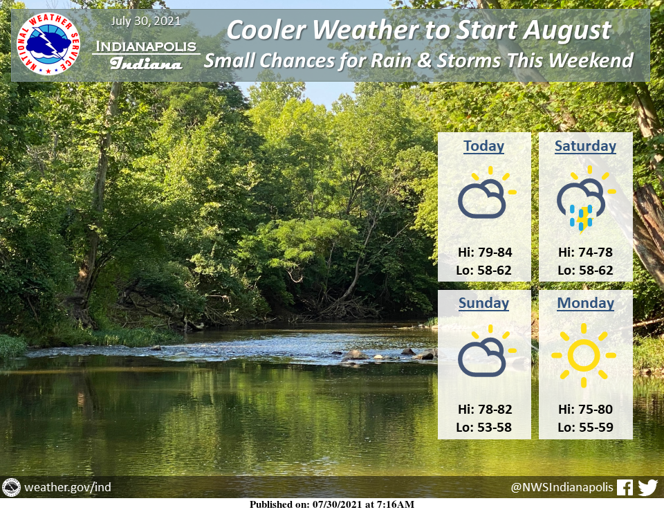
Dry and cool conditions will move into central Indiana today, with highs in the low 80s this afternoon.
Mainly dry conditions are expected over the next few days with the exception of scattered showers and thunderstorms late Saturday evening and Saturday night.
INDIANAPOLIS 7-DAY EXTENDED FORECAST
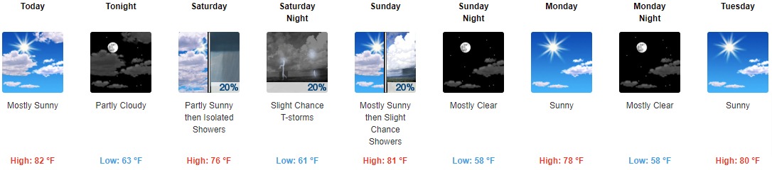
Today: Mostly sunny, with a high near 82. North northeast wind around 10 mph.
Tonight: Partly cloudy, with a low around 63. North wind 5 to 7 mph.
Saturday: Isolated showers after 2pm. Partly sunny, with a high near 76. Light and variable wind becoming southwest around 6 mph in the afternoon. The chance of precipitation is 20%.
Saturday Night: A 20 percent chance of showers and thunderstorms before 2am. Partly cloudy, with a low around 61. West wind around 5 mph becoming calm in the evening.
Sunday: A 20 percent chance of showers after 2pm. Mostly sunny, with a high near 81. West northwest wind 5 to 10 mph.
Sunday Night: Mostly clear, with a low around 58.
Monday: Sunny, with a high near 78.
Monday Night: Mostly clear, with a low around 58.
Tuesday: Sunny, with a high near 80.
Tuesday Night: Mostly clear, with a low around 60.
Wednesday: Sunny, with a high near 83.
Wednesday Night: Mostly clear, with a low around 63.
Thursday: Mostly sunny, with a high near 85.
THE UNITED STATES OF AMERICA 3-DAY OUTLOOK


SOURCE: NWS Indianapolis.
Follow NWS Indianapolis on Twitter @NWSIndianapolis for the latest Indianapolis area weather news.