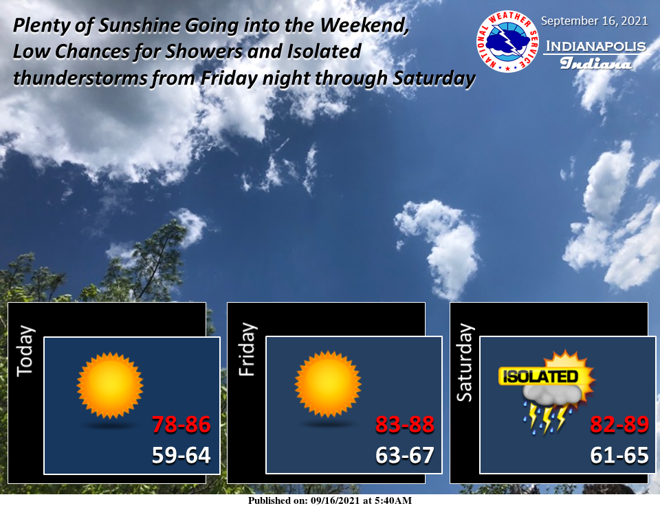
The heat returns for the weekend with plenty of sunshine…low chances for isolated showers/thunderstorms from Friday night through Saturday.
INDIANAPOLIS 7-DAY EXTENDED FORECAST
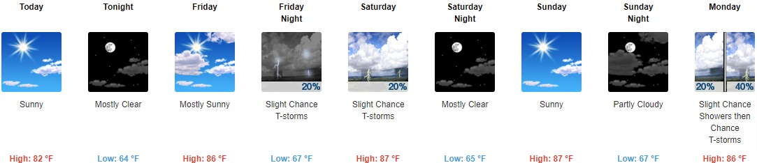
Today: Sunny, with a high near 82. Calm wind becoming east southeast 5 to 7 mph in the morning.
Tonight: Mostly clear, with a low around 64. East wind around 6 mph.
Friday: Mostly sunny, with a high near 86. South wind 3 to 5 mph.
Friday Night: A slight chance of showers and thunderstorms. Partly cloudy, with a low around 67. Light south wind. The chance of precipitation is 20%.
Saturday: A slight chance of showers, with thunderstorms also possible after 11am. Sunny, with a high near 87. Calm wind becoming north northeast around 5 mph in the afternoon. The chance of precipitation is 20%.
Saturday Night: Mostly clear, with a low around 65.
Sunday: Sunny, with a high near 87.
Sunday Night: Partly cloudy, with a low around 67.
Monday: A slight chance of showers, then a chance of showers and thunderstorms after 2pm. Mostly sunny, with a high near 86. The chance of precipitation is 40%.
Monday Night: A chance of showers and thunderstorms. Mostly cloudy, with a low around 68. The chance of precipitation is 30%.
Tuesday: A 50 percent chance of showers. Partly sunny, with a high near 80.
Tuesday Night: A 40 percent chance of showers and thunderstorms. Mostly cloudy, with a low around 65.
Wednesday: A 50 percent chance of showers and thunderstorms. Partly sunny, with a high near 78.
THE UNITED STATES OF AMERICA 3-DAY OUTLOOK


SOURCE: NWS Indianapolis.
Follow NWS Indianapolis on Twitter @NWSIndianapolis for the latest Indianapolis area weather news.