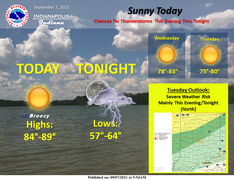
Strong southwest winds ahead of a cold front will bump today's highs back into the mid to upper 80s.
As the cold front moves through this evening and tonight, showers and thunderstorms will form along and ahead of it.
Some of the storms could become strong to severe at times across the northern counties.
The main threats will be damaging winds, lightning, and brief downpours.
After that, expect dry conditions through the extended period and slightly below normal temperatures again before a warming trend this weekend.
INDIANAPOLIS 7-DAY EXTENDED FORECAST
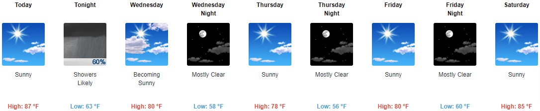
Today: Sunny, with a high near 87. Southwest wind 7 to 16 mph, with gusts as high as 24 mph.
Tonight: Scattered showers and thunderstorms before 11pm, then showers likely and possibly a thunderstorm between 11pm and 2am, then scattered showers and thunderstorms after 2am. Increasing clouds, with a low around 63. South southwest wind 9 to 13 mph, with gusts as high as 21 mph. The chance of precipitation is 60%. New rainfall amounts of less than a tenth of an inch, except higher amounts possible in thunderstorms.
Wednesday: Partly sunny, then gradually becoming sunny, with a high near 80. West northwest wind 7 to 10 mph.
Wednesday Night: Mostly clear, with a low around 58. West wind 3 to 8 mph.
Thursday: Sunny, with a high near 78. Light northwest wind increasing to 5 to 9 mph in the morning.
Thursday Night: Mostly clear, with a low around 56.
Friday: Sunny, with a high near 80.
Friday Night: Mostly clear, with a low around 60.
Saturday: Sunny, with a high near 85.
Saturday Night: Mostly clear, with a low around 65.
Sunday: Sunny, with a high near 82.
Sunday Night: Mostly clear, with a low around 61.
Monday: Sunny, with a high near 83.
THE UNITED STATES OF AMERICA 3-DAY OUTLOOK


SOURCE: NWS Indianapolis.
Follow NWS Indianapolis on Twitter @NWSIndianapolis for the latest Indianapolis area weather news.