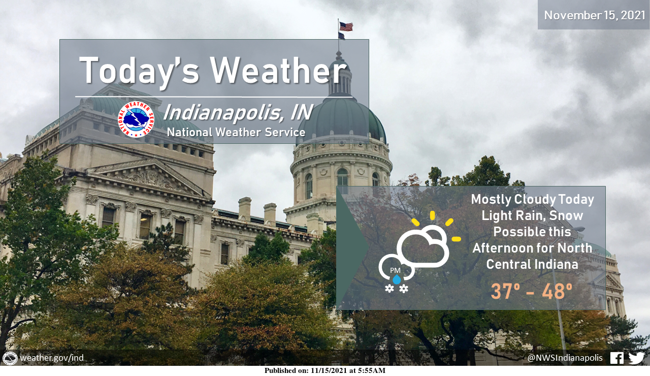
Today will be cloudy and chilly.
Light rain and snow will be possible this afternoon, especially north and east of I-74.
Only minor, brief accumulations are expected across the northern portion of the forecast area.
INDIANAPOLIS 7-DAY EXTENDED FORECAST
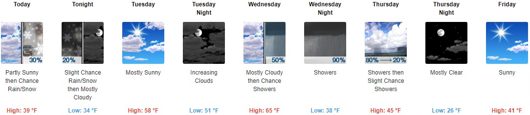
Today: A chance of rain and snow, mainly after 4pm. Increasing clouds, with a high near 39. West southwest wind around 8 mph. The chance of precipitation is 30%.
Tonight: A slight chance of rain and snow before 8pm. Cloudy, then gradually becoming partly cloudy, with a low around 34. Southeast wind 5 to 7 mph. The chance of precipitation is 20%.
Tuesday: Mostly sunny, with a high near 58. South southeast wind 5 to 7 mph.
Tuesday Night: Increasing clouds, with a low around 51. South southeast wind 8 to 13 mph, with gusts as high as 23 mph.
Wednesday: A 50 percent chance of showers after 2pm. Mostly cloudy, with a high near 65. South southwest wind 13 to 16 mph, with gusts as high as 28 mph. New precipitation amounts of less than a tenth of an inch are possible.
Wednesday Night: Showers, mainly after 8pm. Low around 38. The chance of precipitation is 90%. New precipitation amounts between a quarter and half of an inch possible.
Thursday: Showers, mainly before 8am. High near 45. The chance of precipitation is 80%.
Thursday Night: Mostly clear, with a low around 26.
Friday: Sunny, with a high near 41.
Friday Night: Partly cloudy, with a low around 29.
Saturday: Partly sunny, with a high near 47.
Saturday Night: A 30 percent chance of showers. Mostly cloudy, with a low around 37.
Sunday: A 30 percent chance of showers. Mostly sunny, with a high near 51.
THE UNITED STATES OF AMERICA 3-DAY OUTLOOK


SOURCE: NWS Indianapolis.
Follow NWS Indianapolis on Twitter @NWSIndianapolis for the latest Indianapolis area weather news.