Cooler temperatures have returned to central Indiana behind the cold front that passed through the area overnight.
Expect dry but breezy conditions today.
INDIANAPOLIS 7-DAY EXTENDED FORECAST
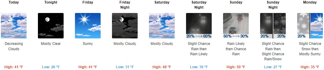
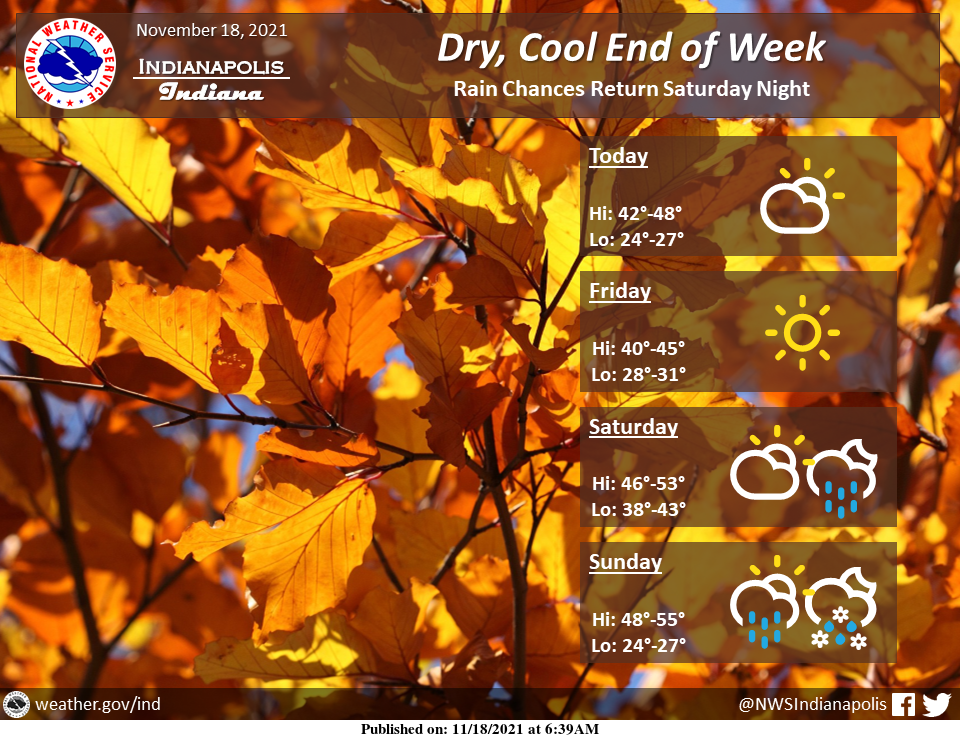
Today: Mostly cloudy, then gradually becoming sunny, with a steady temperature around 41. West wind 8 to 15 mph, with gusts as high as 25 mph.
Tonight: Mostly clear, with a low around 26. West northwest wind 6 to 11 mph, with gusts as high as 22 mph.
Friday: Sunny, with a high near 41. West northwest wind around 5 mph becoming calm in the morning.
Friday Night: Mostly cloudy, with a low around 31. South southeast wind 3 to 6 mph.
Saturday: Mostly cloudy, with a high near 48. South wind 6 to 9 mph.
Saturday Night: Rain likely, mainly after 2am. Mostly cloudy, with a low around 39. The chance of precipitation is 60%. New precipitation amounts between a tenth and a quarter of an inch possible.
Sunday: Rain likely, mainly before 8am. Mostly cloudy, with a high near 50. The chance of precipitation is 60%.
Sunday Night: A slight chance of rain after 8pm, mixing with snow after 2am. Partly cloudy, with a low around 27. The chance of precipitation is 20%.
Monday: A 20 percent chance of snow before 8am. Mostly sunny, with a high near 35.
Monday Night: Mostly clear, with a low around 23.
Tuesday: Sunny, with a high near 41.
Tuesday Night: Partly cloudy, with a low around 31.
Wednesday: A chance of rain and snow. Partly sunny, with a high near 48. Chance of precipitation is 30%.
THE UNITED STATES OF AMERICA 3-DAY OUTLOOK


SOURCE: NWS Indianapolis.
Follow NWS Indianapolis on Twitter @NWSIndianapolis for the latest Indianapolis area weather news.