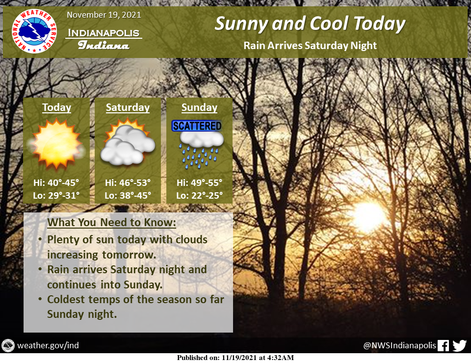
Sunny skies are expected today with temperatures slightly below normal.
Clouds will be on the increase tomorrow ahead of the rain that will move through tomorrow night and Sunday.
The coldest night of the season so far is expected Sunday night with lows in the low to mid-20s.
INDIANAPOLIS 7-DAY EXTENDED FORECAST
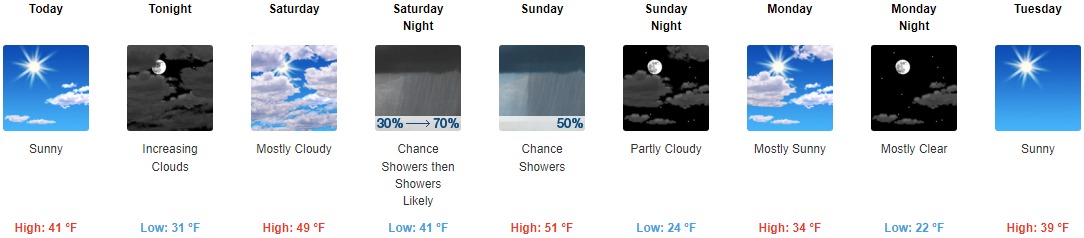
Today: Sunny, with a high near 41. Calm wind becoming south southeast 5 to 7 mph in the afternoon.
Tonight: Increasing clouds, with a low around 31. Southeast wind around 7 mph.
Saturday: Mostly cloudy, with a high near 49. South wind around 9 mph, with gusts as high as 18 mph.
Saturday Night: Showers likely, mainly after 1am. Mostly cloudy, with a low around 41. South wind around 6 mph. The chance of precipitation is 70%. New precipitation amounts of less than a tenth of an inch are possible.
Sunday: A 50 percent chance of showers, mainly before 1pm. Mostly cloudy, with a high near 51. West wind 6 to 9 mph. New precipitation amounts between a tenth and a quarter of an inch possible.
Sunday Night: Partly cloudy, with a low around 24.
Monday: Mostly sunny, with a high near 34.
Monday Night: Mostly clear, with a low around 22.
Tuesday: Sunny, with a high near 39.
Tuesday Night: Partly cloudy, with a low around 30.
Wednesday: A 40 percent chance of showers. Partly sunny, with a high near 48.
Wednesday Night: A 40 percent chance of showers. Mostly cloudy, with a low around 41.
Thanksgiving Day: A 40 percent chance of showers. Mostly cloudy, with a high near 51.
THE UNITED STATES OF AMERICA 3-DAY OUTLOOK


SOURCE: NWS Indianapolis.
Follow NWS Indianapolis on Twitter @NWSIndianapolis for the latest Indianapolis area weather news.