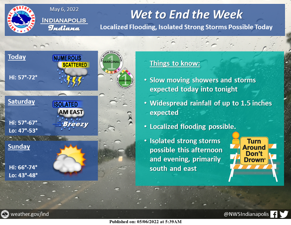
Low pressure moving through the Ohio Valley today and tonight will produce widespread showers and scattered thunderstorms.
A few storms could be strong with localized damaging winds or large hail.
Heavy rain and localized flooding are also possible.
Drier and milder weather is expected as the weekend wears on.
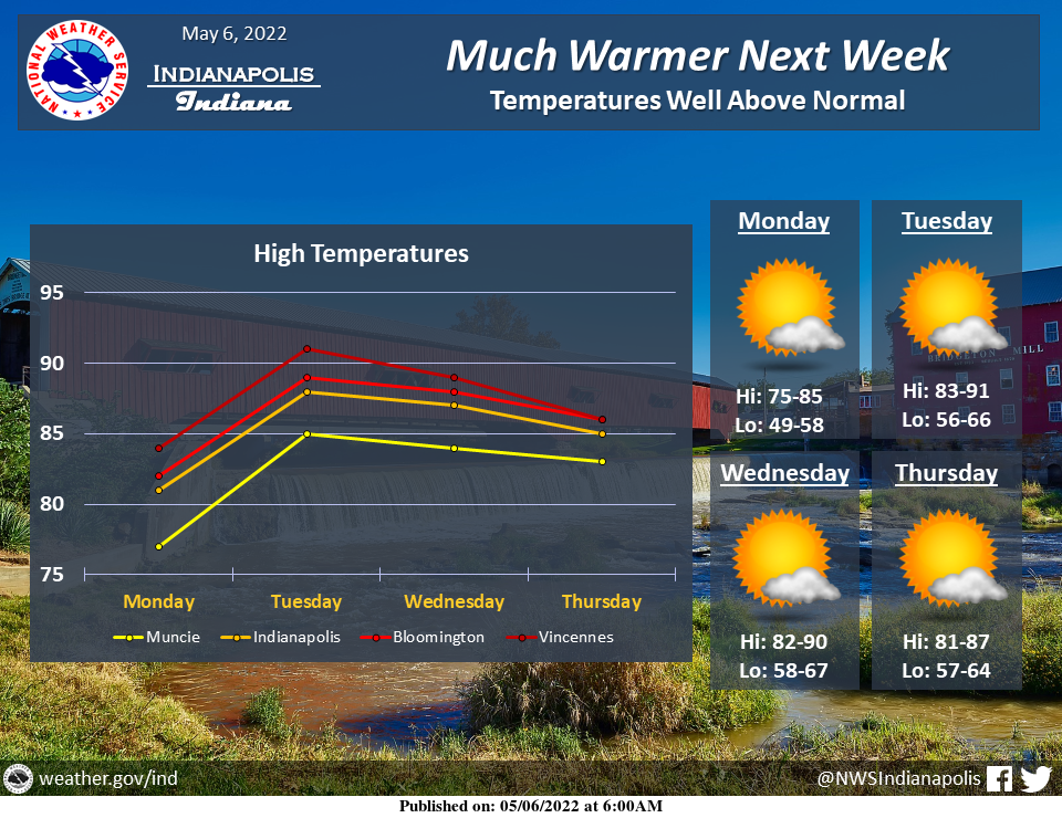
Dry weather but much above normal temperatures are expected next week, with highs reaching well into the 80s most days and 90 degree readings possible across portions of the area mid week.
INDIANAPOLIS 7-DAY EXTENDED FORECAST
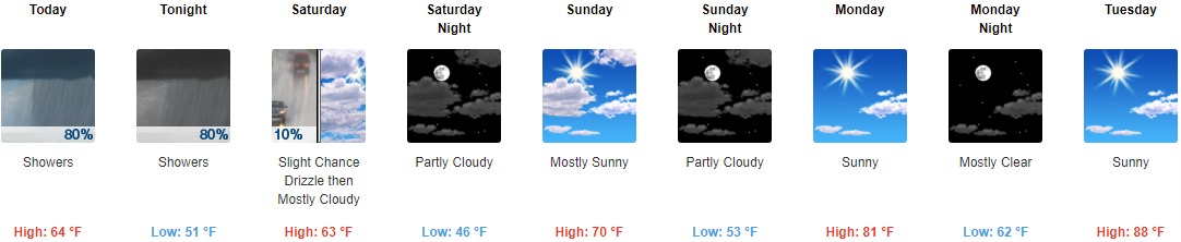
Today: Showers and thunderstorms likely, then showers and possibly a thunderstorm after 3pm. High near 64. Light and variable wind becoming north 5 to 7 mph in the afternoon. The chance of precipitation is 80%. New rainfall amounts between a quarter and half of an inch possible.
Tonight: Showers and possibly a thunderstorm before 2am, then scattered showers between 2am and 5am, then a slight chance of drizzle after 5am. Low around 51. North wind 10 to 15 mph, with gusts as high as 30 mph. The chance of precipitation is 80%. New precipitation amounts between a quarter and half of an inch possible.
Saturday: A slight chance of drizzle before 8am. Mostly cloudy, with a high near 63. North northeast wind around 15 mph, with gusts as high as 30 mph.
Saturday Night: Partly cloudy, with a low around 46. Northeast wind 6 to 10 mph.
Sunday: Mostly sunny, with a high near 70. East southeast wind 6 to 9 mph, with gusts as high as 18 mph.
Sunday Night: Partly cloudy, with a low around 53.
Monday: Sunny, with a high near 81.
Monday Night: Mostly clear, with a low around 62.
Tuesday: Sunny, with a high near 88.
Tuesday Night: Mostly clear, with a low around 63.
Wednesday: Sunny, with a high near 87.
Wednesday Night: Mostly clear, with a low around 61.
Thursday: Sunny, with a high near 85.
THE UNITED STATES OF AMERICA 3-DAY OUTLOOK


SOURCE: NWS Indianapolis.
Follow NWS Indianapolis on Twitter @NWSIndianapolis for the latest Indianapolis area weather news.