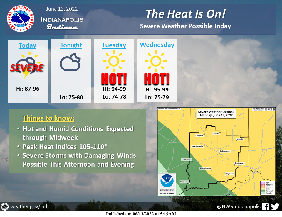
The beginning of multiple days with dangerous heat and humidity will begin across central Indiana today as temperatures rise into the low and mid-90s.
A cluster of severe thunderstorms may expand into the northeast half of the area later this afternoon, likely producing damaging winds, torrential rainfall, and constant lightning.
The threat of rain and storms will end this evening as the core of heat builds across the Ohio Valley for Tuesday and Wednesday.
Highs on both days will be in the mid and upper 90s with heat indices peaking at 105 to 110°.
STAY INSIDE…OR IN A POOL…AND HYDRATE
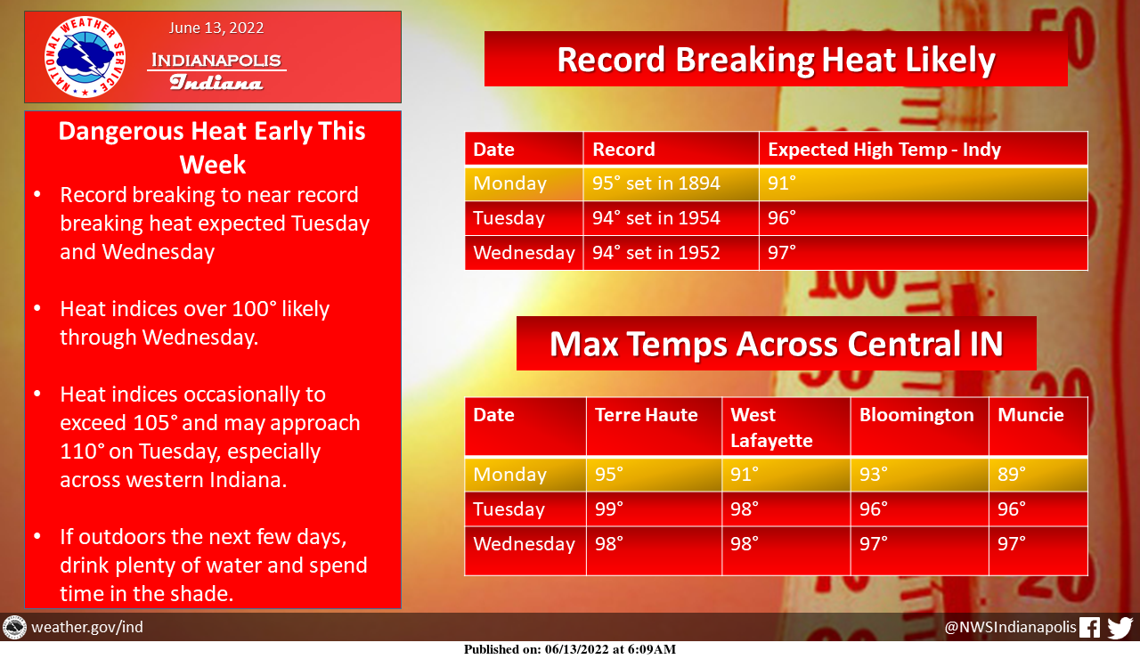
Record to near record-breaking heat is likely Tuesday and Wednesday with highs in the mid to upper 90s.
Heat indices over 100 are likely with periods of 105 to 110 possible at times.
Plan ahead if you're going to be outdoors!
A heat wave is coming to central Indiana today through Wednesday with highs in the mid to upper 90s, so make sure you are prepared!#HeatSafety #BeatTheHeat #INwx pic.twitter.com/HlFNq5rAFK
— NWS Indianapolis (@NWSIndianapolis) June 13, 2022
INDIANAPOLIS 7-DAY EXTENDED FORECAST

Today: A 40 percent chance of showers and thunderstorms, mainly after 1pm. Partly sunny and hot, with a high near 91. Heat index values as high as 102. South southwest wind 6 to 9 mph, with gusts as high as 18 mph.
Tonight: A chance of thunderstorms before 7pm. Partly cloudy, with a low around 77. South southwest wind 6 to 9 mph, with gusts as high as 21 mph. Chance of precipitation is 30%.
Tuesday: Sunny and hot, with a high near 98. Heat index values as high as 106. Southwest wind 5 to 8 mph.
Tuesday Night: Mostly clear, with a low around 76. Southwest wind 6 to 9 mph.
Wednesday: Sunny and hot, with a high near 98. South southwest wind 7 to 9 mph.
Wednesday Night: A 20 percent chance of showers and thunderstorms after 2am. Mostly clear, with a low around 77.
Thursday: A slight chance of showers and thunderstorms before 8am, then a slight chance of showers and thunderstorms after 2pm. Sunny and hot, with a high near 96. Chance of precipitation is 20%.
Thursday Night: A 20 percent chance of showers and thunderstorms before 2am. Partly cloudy, with a low around 69.
Friday: Sunny, with a high near 89.
Friday Night: Clear, with a low around 63.
Saturday: Sunny, with a high near 88.
Saturday Night: Mostly clear, with a low around 61.
Sunday: Mostly sunny, with a high near 89.
THE UNITED STATES OF AMERICA 3-DAY OUTLOOK


SOURCE: NWS Indianapolis.
Follow NWS Indianapolis on Twitter @NWSIndianapolis for the latest Indianapolis area weather news.