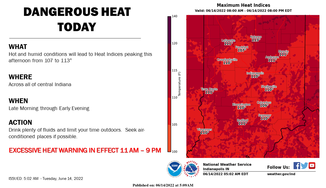
The hottest weather in nearly a decade is expected today as temperatures rise into the mid and upper 90s.
With high humidity, heat indices will also peak from 107° to 113° this afternoon.
An Excessive Heat Warning will be in effect from 11 am through 9 pm EDT.
Wear light colors, limit outdoor exposure, and stay hydrated!
RECORD-BREAKING HEAT
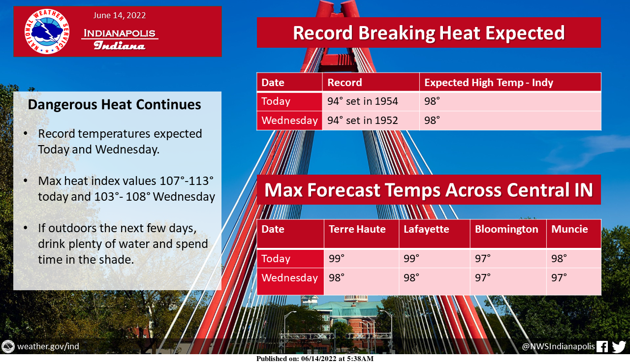
Record-breaking heat is expected today and Wednesday with highs in the mid to upper 90s.
Heat indices near or over 110 are possible at times later today.
Humidity will gradually lessen through the week as the hottest temperatures arrive.
Plan ahead if you're going to be outdoors!
DO NOT LOCK PEOPLE & PETS IN HOT CARS

Heat indices will rise above 105° later today with some locations even peaking above 110°. Remember to Look Before You Lock!
INDIANAPOLIS 7-DAY EXTENDED FORECAST
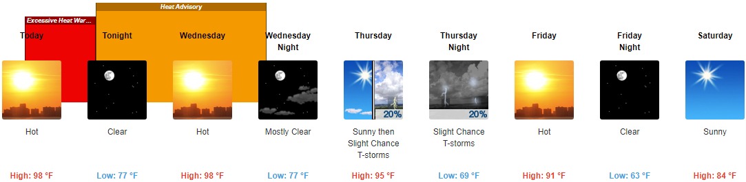
Today: Mostly sunny and hot, with a high near 98. Heat index values as high as 107. Southwest wind 7 to 9 mph.
Tonight: Clear, with a low around 77. South southwest wind 5 to 10 mph.
Wednesday: Sunny and hot, with a high near 98. Light south southwest wind increasing to 5 to 9 mph in the morning.
Wednesday Night: Mostly clear, with a low around 77. South southwest wind 8 to 10 mph, with gusts as high as 20 mph.
Thursday: A 20 percent chance of showers and thunderstorms after 3pm. Mostly sunny and hot, with a high near 95. West wind 9 to 14 mph, with gusts as high as 21 mph.
Thursday Night: A 20 percent chance of showers and thunderstorms before 3am. Mostly clear, with a low around 69.
Friday: Sunny and hot, with a high near 91.
Friday Night: Clear, with a low around 63.
Saturday: Sunny, with a high near 84.
Saturday Night: Mostly clear, with a low around 58.
Sunday: Sunny, with a high near 89.
Sunday Night: Mostly clear, with a low around 64.
Monday: Sunny and hot, with a high near 95.
THE UNITED STATES OF AMERICA 3-DAY OUTLOOK


SOURCE: NWS Indianapolis.
Follow NWS Indianapolis on Twitter @NWSIndianapolis for the latest Indianapolis area weather news.