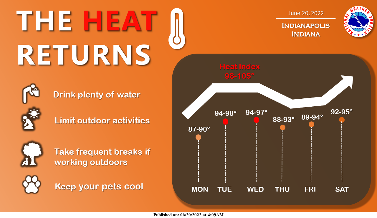
Summer is in full force across Indiana as we usher in the official start of the season with another heat wave.
Temperatures reach the mid to upper 90s by Tuesday while humidity levels peak on Wednesday with heat indices possibly topping 100 degrees during the afternoon hours.
Remember to drink plenty of water and limit outdoor activities during the peak heating of the day.
INDIANAPOLIS 7-DAY EXTENDED FORECAST
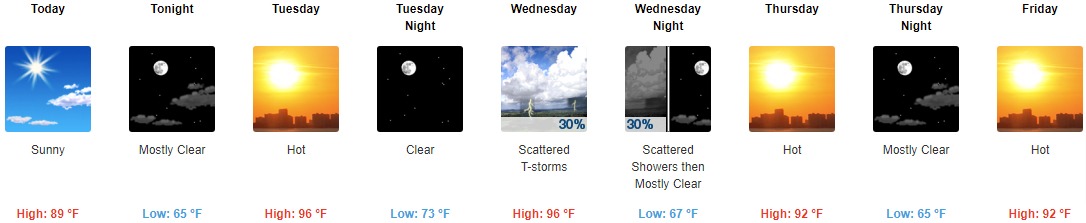
Today: Sunny, with a high near 89. Southwest wind 3 to 8 mph.
Tonight: Mostly clear, with a low around 65. South southwest wind 5 to 8 mph.
Tuesday: Sunny and hot, with a high near 96. West southwest wind 5 to 10 mph.
Tuesday Night: Clear, with a low around 73. West southwest wind 6 to 10 mph.
Wednesday: Scattered showers and thunderstorms, mainly after 3pm. Mostly sunny and hot, with a high near 96. West wind 5 to 8 mph. Chance of precipitation is 30%.
Wednesday Night: Scattered showers and thunderstorms before 9pm. Partly cloudy, with a low around 67. Chance of precipitation is 30%.
Thursday: Sunny and hot, with a high near 92.
Thursday Night: Mostly clear, with a low around 65.
Friday: Mostly sunny and hot, with a high near 92.
Friday Night: Partly cloudy, with a low around 70.
Saturday: A 20 percent chance of showers. Partly sunny and hot, with a high near 94.
Saturday Night: A 20 percent chance of showers. Mostly cloudy, with a low around 72.
Sunday: A 20 percent chance of showers and thunderstorms. Partly sunny and hot, with a high near 91.
THE UNITED STATES OF AMERICA 3-DAY OUTLOOK


SOURCE: NWS Indianapolis.
Follow NWS Indianapolis on Twitter @NWSIndianapolis for the latest Indianapolis area weather news.