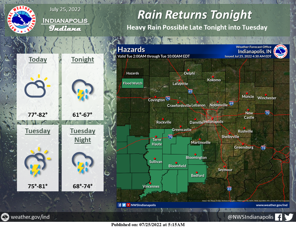
Look for partly to mostly cloudy skies today with highs around 80.
Scattered to numerous showers and thunderstorms return tonight and will continue into mid-week.
Heavy rain is possible late tonight into Tuesday, mainly across southwest portions of central Indiana, where a Flood Watch is in effect.
Lows tonight will be in the 60s, with highs on Tuesday in the mid-70s to around 80.
FLOOD WATCH SOUTHWEST
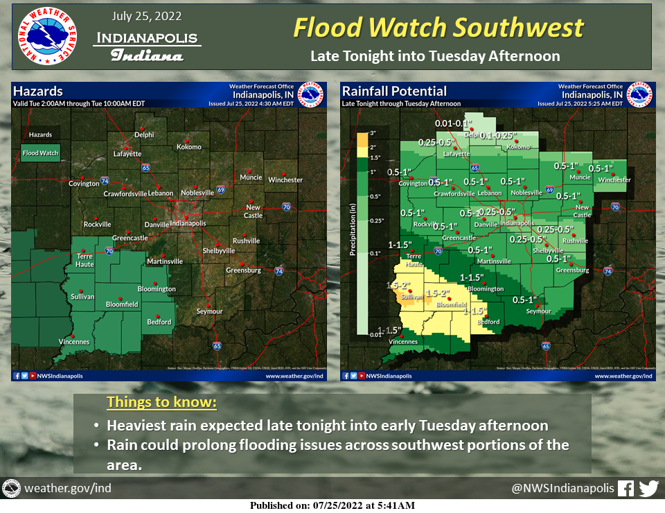
Showers and thunderstorms, some possibly with heavy rain, will return to central Indiana tonight into Tuesday.
These may create flooding, especially across southwest sections of the area.
This area is forecast to receive the most rain and parts of this area have already seen heavy rain recently.
Do not drive where water covers the road. Turn around, don't drown!
INDIANAPOLIS 7-DAY EXTENDED FORECAST
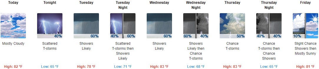
Today: Mostly cloudy, with a high near 82. Northwest wind 3 to 7 mph.
Tonight: Scattered showers and thunderstorms, mainly after 2am. Mostly cloudy, with a low around 65. North wind around 6 mph becoming light and variable in the evening. The chance of precipitation is 40%.
Tuesday: Scattered showers and thunderstorms before 8am, then showers likely and possibly a thunderstorm between 8am and 2pm, then scattered showers and thunderstorms after 2pm. Mostly cloudy, with a high near 78. East wind 5 to 7 mph becoming south southeast in the afternoon. The chance of precipitation is 60%. New rainfall amounts between a quarter and half of an inch possible.
Tuesday Night: Scattered showers and thunderstorms, then showers likely and possibly a thunderstorm after 2am. Mostly cloudy, with a low around 71. Southeast wind around 6 mph becoming light and variable after midnight. The chance of precipitation is 60%. New rainfall amounts between a quarter and half of an inch possible.
Wednesday: Showers likely and possibly a thunderstorm before 8am, then a chance of showers and thunderstorms between 8am and 2pm, then showers likely and possibly a thunderstorm after 2pm. Mostly cloudy, with a high near 83. West southwest wind 6 to 10 mph. Chance of precipitation is 60%. New rainfall amounts between a quarter and half of an inch possible.
Wednesday Night: Showers likely and possibly a thunderstorm before 8pm, then a chance of showers and thunderstorms after 8pm. Mostly cloudy, with a low around 68. The chance of precipitation is 60%. New rainfall amounts between a tenth and quarter of an inch, except higher amounts possible in thunderstorms.
Thursday: A 50 percent chance of showers and thunderstorms. Partly sunny, with a high near 83.
Thursday Night: A chance of showers and thunderstorms before 2am, then a slight chance of showers. Mostly cloudy, with a low around 65. The chance of precipitation is 40%.
Friday: A 10 percent chance of showers before 8am. Mostly sunny, with a high near 81.
Friday Night: Partly cloudy, with a low around 63.
Saturday: Mostly sunny, with a high near 82.
Saturday Night: Partly cloudy, with a low around 65.
Sunday: A 30 percent chance of showers. Mostly sunny, with a high near 84.
THE UNITED STATES OF AMERICA 3-DAY OUTLOOK


SOURCE: NWS Indianapolis.
Follow NWS Indianapolis on Twitter @NWSIndianapolis for the latest Indianapolis area weather news.