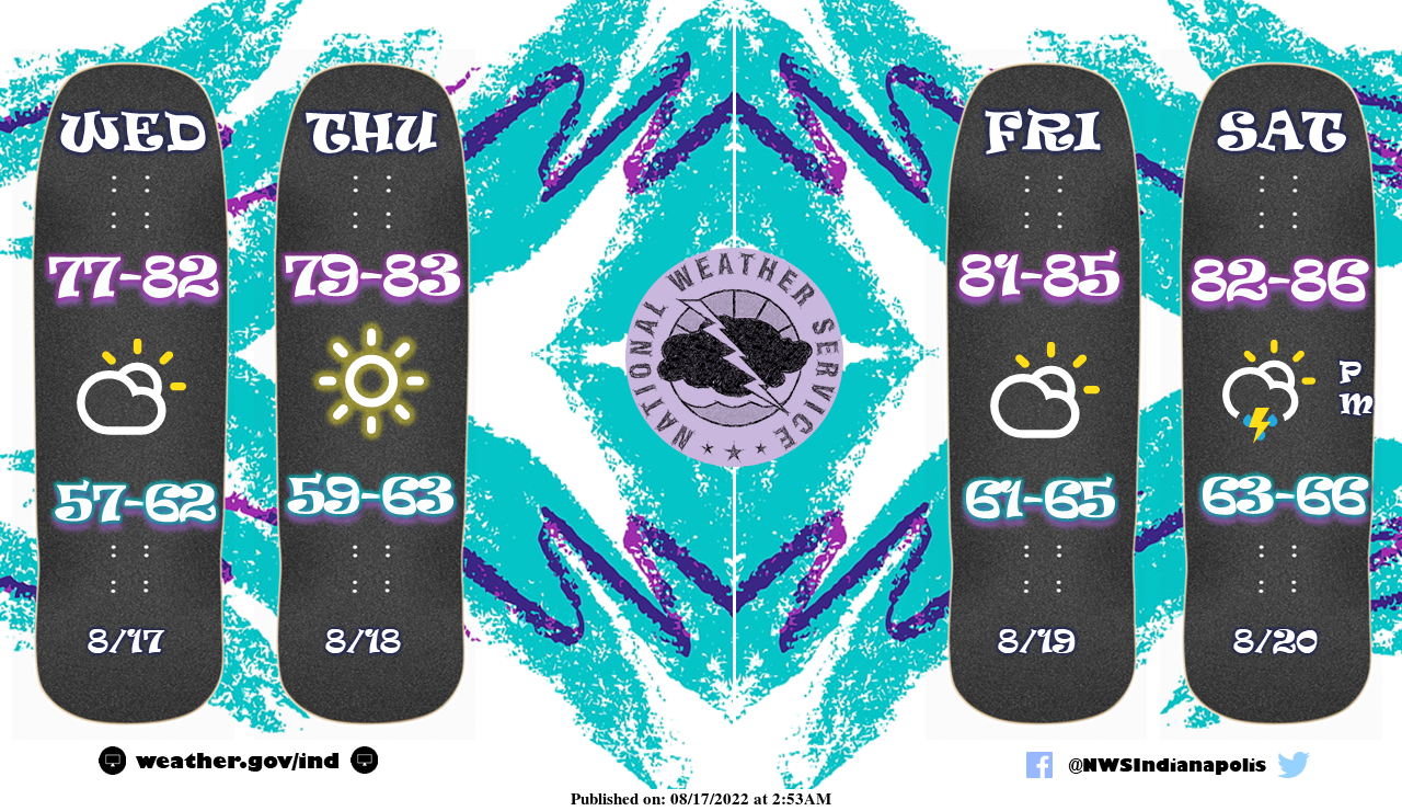
Dry weather and slightly below normal temperatures are in store through the early weekend with unsettled on tap by Saturday afternoon.
INDIANAPOLIS 7-DAY EXTENDED FORECAST
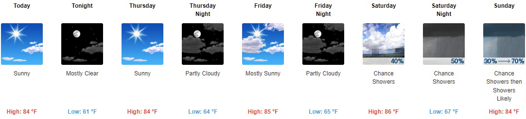
Today: Sunny, with a high near 84. Northeast wind 5 to 9 mph.
Tonight: Mostly clear, with a low around 61. Northeast wind 3 to 7 mph.
Thursday: Sunny, with a high near 84. Calm wind becoming northeast around 5 mph.
Thursday Night: Partly cloudy, with a low around 64. North wind around 5 mph becoming calm in the evening.
Friday: Mostly sunny, with a high near 85. Calm wind becoming south southeast around 5 mph in the afternoon.
Friday Night: Partly cloudy, with a low around 65.
Saturday: A slight chance of showers, then a chance of showers and thunderstorms after 2pm. Mostly sunny, with a high near 86. The chance of precipitation is 40%.
Saturday Night: A 50 percent chance of showers and thunderstorms. Mostly cloudy, with a low around 67.
Sunday: A chance of showers and thunderstorms, then showers likely and possibly a thunderstorm after 2pm. Partly sunny, with a high near 84. The chance of precipitation is 70%.
Sunday Night: Showers likely and possibly a thunderstorm before 8pm, then a chance of showers and thunderstorms between 8pm and 2am, then a chance of showers after 2am. Mostly cloudy, with a low around 66. The chance of precipitation is 60%.
Monday: A 50 percent chance of showers and thunderstorms. Partly sunny, with a high near 80.
Monday Night: A 20 percent chance of showers and thunderstorms. Partly cloudy, with a low around 65.
Tuesday: A 30 percent chance of showers and thunderstorms. Mostly sunny, with a high near 82.
THE UNITED STATES OF AMERICA 3-DAY OUTLOOK


SOURCE: NWS Indianapolis.
Follow NWS Indianapolis on Twitter @NWSIndianapolis for the latest Indianapolis area weather news.