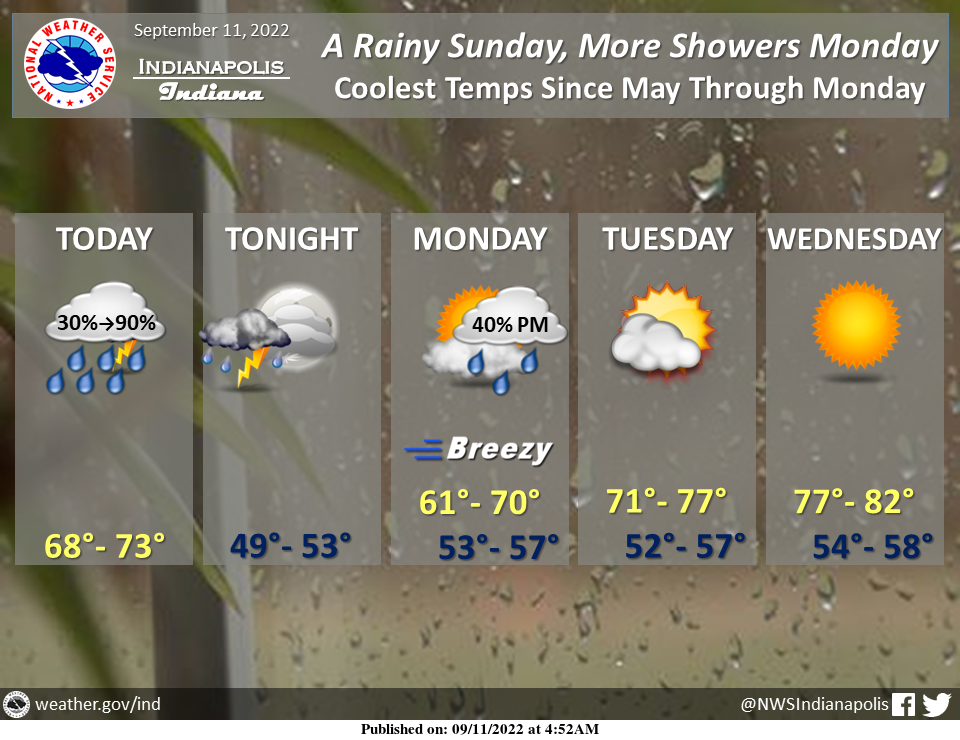
Rain showers will increase in coverage today, with brief heavy downpours this afternoon and early evening possibly leading to isolated flooding.
A few rumbles of thunder are possible but severe weather is not expected.
Cool temperatures today…and quite chilly tonight and into Monday when a few more showers are expected.
Dry and seasonably warm into the midweek.
INDIANAPOLIS 7-DAY EXTENDED FORECAST
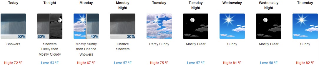
Today: Showers and possibly a thunderstorm. High near 72. Southwest wind 6 to 8 mph. The chance of precipitation is 90%. New rainfall amounts between a quarter and half of an inch possible.
Tonight: Showers and thunderstorms likely, mainly before 9pm. Mostly cloudy, with a low of around 53. West wind 6 to 9 mph. The chance of precipitation is 60%. New precipitation amounts between a tenth and quarter of an inch, except higher amounts possible in thunderstorms.
Monday: A 40 percent chance of showers after 2pm. Partly sunny, with a high near 67. West southwest wind 7 to 13 mph, with gusts as high as 24 mph.
Monday Night: A 30 percent chance of showers, mainly before 8pm. Mostly cloudy, with a low of around 57. West southwest wind 6 to 10 mph, with gusts as high as 18 mph.
Tuesday: Partly sunny, with a high near 75. West northwest wind 6 to 10 mph.
Tuesday Night: Mostly clear, with a low around 57.
Wednesday: Sunny, with a high near 81.
Wednesday Night: Mostly clear, with a low around 58.
Thursday: Sunny, with a high near 82.
Thursday Night: Mostly clear, with a low around 60.
Friday: Sunny, with a high near 83.
Friday Night: Partly cloudy, with a low around 61.
Saturday: Sunny, with a high near 85.
THE UNITED STATES OF AMERICA 3-DAY OUTLOOK


SOURCE: NWS Indianapolis.
Follow NWS Indianapolis on Twitter @NWSIndianapolis for the latest Indianapolis area weather news.