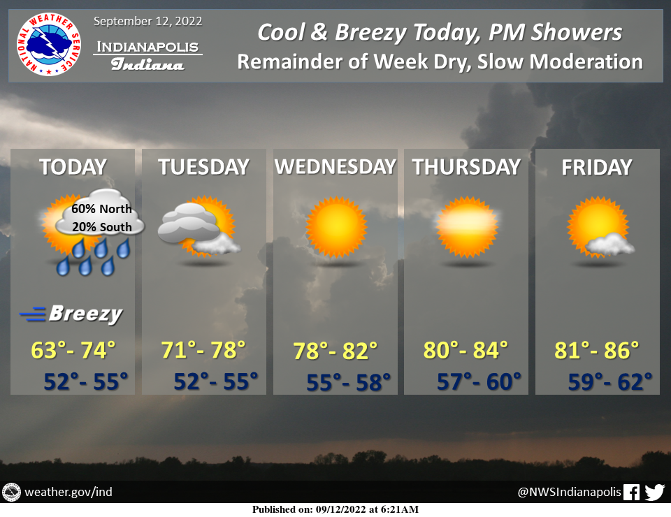
Clouds will increase today as a final round of showers crosses the region this afternoon, with the greatest coverage north of the I-70 corridor.
Showers will taper off this evening from west to east, although clouds and below-normal temperatures will linger into Tuesday.
Dry, mostly clear, and progressively warmer through Friday.
INDIANAPOLIS 7-DAY EXTENDED FORECAST
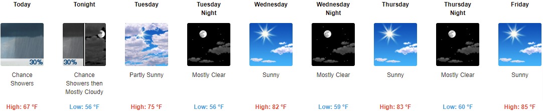
Today: A 30 percent chance of showers, mainly after 3pm. Increasing clouds, with a high near 67. West southwest wind 10 to 13 mph, with gusts as high as 23 mph.
Tonight: A 30 percent chance of showers before 9pm. Mostly cloudy, with a low of around 56. West wind 6 to 10 mph, with gusts as high as 20 mph.
Tuesday: Partly sunny, with a high near 75. West northwest wind 6 to 9 mph.
Tuesday Night: Mostly clear, with a low around 56. West northwest wind around 6 mph becoming calm in the evening.
Wednesday: Sunny, with a high near 82. Calm wind.
Wednesday Night: Mostly clear, with a low around 59.
Thursday: Sunny, with a high near 83.
Thursday Night: Mostly clear, with a low around 60.
Friday: Sunny, with a high near 85.
Friday Night: Mostly clear, with a low of around 63.
Saturday: Sunny, with a high near 87.
Saturday Night: Mostly clear, with a low around 64.
Sunday: Sunny, with a high near 86.
THE UNITED STATES OF AMERICA 3-DAY OUTLOOK


SOURCE: NWS Indianapolis.
Follow NWS Indianapolis on Twitter @NWSIndianapolis for the latest Indianapolis area weather news.