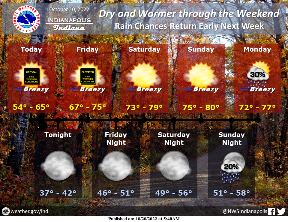
Dry and warmer weather is expected through this weekend, with breezy conditions each day.
Fire weather conditions will be critical today and elevated Friday.
Shower chances return early next week.
Red Flag Warning Today
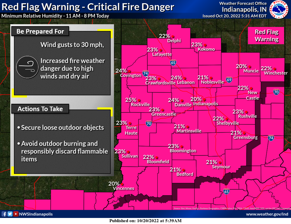
A Red Flag Warning is in effect today from 11 AM to 8 PM. Strong winds will combine with low humidity values to create critical fire weather conditions. Avoid outdoor burning and properly dispose of flammable items.
INDIANAPOLIS 7-DAY EXTENDED FORECAST
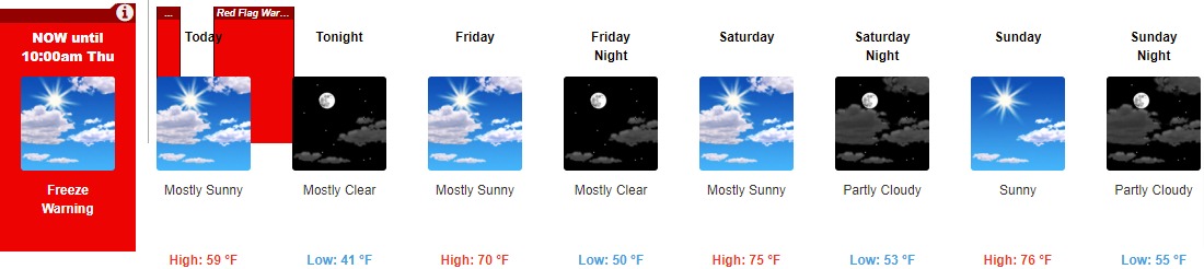
Today: Mostly sunny, with a high near 59. Southwest wind 9 to 15 mph, with gusts as high as 25 mph.
Tonight: Mostly clear, with a low of around 41. South southwest wind around 8 mph.
Friday: Mostly sunny, with a high near 70. South southwest wind 6 to 15 mph, with gusts as high as 26 mph.
Friday Night: Mostly clear, with a low of around 50. South wind around 9 mph, with gusts as high as 18 mph.
Saturday: Mostly sunny, with a high near 75. South wind 7 to 14 mph, with gusts as high as 25 mph.
Saturday Night: Partly cloudy, with a low of around 53.
Sunday: Sunny, with a high near 76.
Sunday Night: Partly cloudy, with a low around 55.
Monday: A 20 percent chance of showers after 2pm. Mostly sunny, with a high near 75.
Monday Night: A 40 percent chance of showers, mainly after 8pm. Mostly cloudy, with a low of around 53.
Tuesday: A 30 percent chance of showers. Partly sunny, with a high near 66.
Tuesday Night: A 30 percent chance of showers. Mostly cloudy, with a low of around 46.
Wednesday: A 20 percent chance of showers. Mostly sunny, with a high near 60.
THE UNITED STATES OF AMERICA 3-DAY OUTLOOK


SOURCE: NWS Indianapolis.
Follow NWS Indianapolis on Twitter @NWSIndianapolis for the latest Indianapolis area weather news.