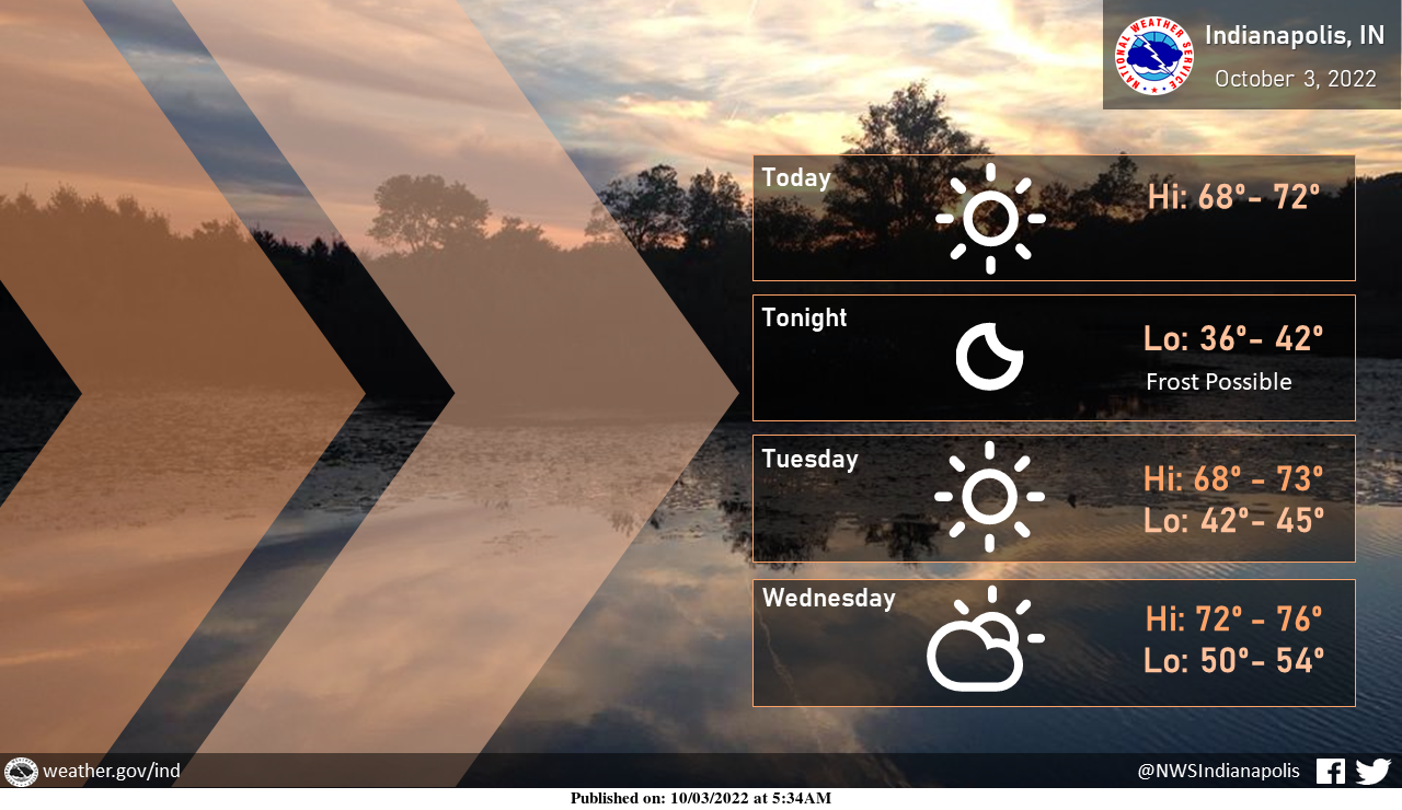
Clear skies are expected to continue through tomorrow, with some clouds arriving on Wednesday.
Some patchy frost is possible tonight before a slight warming trend begins.
Enjoy the beautiful weather!

Another cold night is in store tonight, and this will allow some patchy frost to form late.
Areas north of Interstate 70 are the most likely to see the patchy frost.
Low temperatures across areas north of I-70 will be in the middle and upper 30s.
INDIANAPOLIS 7-DAY EXTENDED FORECAST
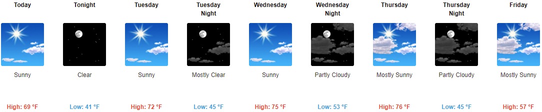
Today: Sunny, with a high near 69. Northeast wind 6 to 9 mph.
Tonight: Clear, with a low around 41. East northeast wind 5 to 7 mph.
Tuesday: Sunny, with a high near 72. Calm wind.
Tuesday Night: Mostly clear, with a low around 45. Calm wind.
Wednesday: Sunny, with a high near 75. Light and variable wind.
Wednesday Night: Partly cloudy, with a low of around 53.
Thursday: Mostly sunny, with a high near 76.
Thursday Night: Partly cloudy, with a low of around 45.
Friday: Mostly sunny, with a high near 57.
Friday Night: Partly cloudy, with a low of around 37.
Saturday: Areas of frost. Otherwise, sunny, with a high near 58.
Saturday Night: Mostly clear, with a low around 36.
Sunday: Areas of frost. Otherwise, sunny, with a high near 63.
THE UNITED STATES OF AMERICA 3-DAY OUTLOOK


SOURCE: NWS Indianapolis.
Follow NWS Indianapolis on Twitter @NWSIndianapolis for the latest Indianapolis area weather news.