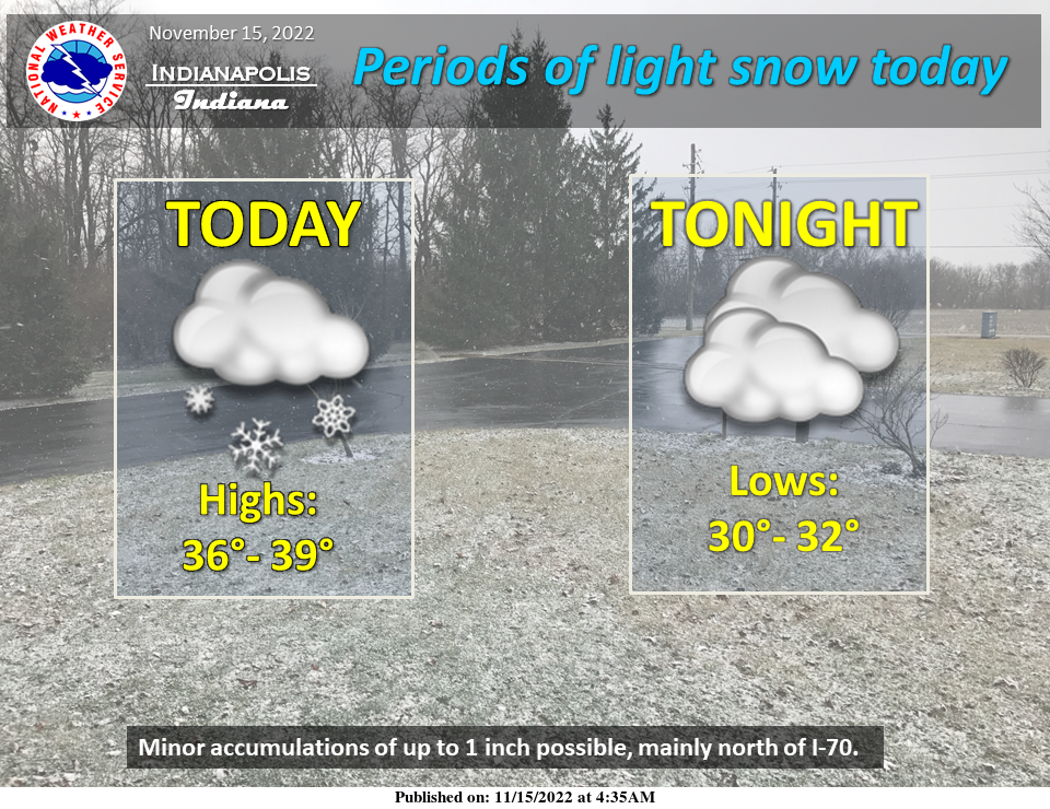
Periods of light snow are expected today.
Across southern portions of the area, the snow may change to rain due to warmer temperatures.
Light accumulations are possible mainly north of I-70.
INDIANAPOLIS 7-DAY EXTENDED FORECAST
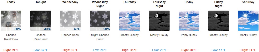
Today: Scattered snow showers before 11am, then a chance of rain and snow showers. Cloudy, with a high near 39. East wind around 6 mph becoming calm in the afternoon. The chance of precipitation is 50%. New precipitation amounts to less than a tenth of an inch possible.
Tonight: A chance of rain and snow showers, mainly before 10pm. Cloudy, with a low of around 32. West wind 3 to 8 mph. The chance of precipitation is 40%.
Wednesday: Occasional flurries with a chance of snow. Mostly cloudy, with a high near 36. West southwest wind 6 to 11 mph, with gusts as high as 21 mph. The chance of precipitation is 40%.
Wednesday Night: Occasional flurries with a slight chance of snow. Mostly cloudy, with a low of around 28. West wind 8 to 10 mph, with gusts as high as 21 mph. The chance of precipitation is 20%.
Thursday: Mostly cloudy, with a high near 35. West southwest wind 8 to 11 mph, with gusts as high as 22 mph.
Thursday Night: Mostly cloudy, with a low of around 21.
Friday: Partly sunny, with a high near 28.
Friday Night: Mostly cloudy, with a low of around 17.
Saturday: Mostly sunny, with a high near 31.
Saturday Night: Partly cloudy, with a low around 17.
Sunday: Sunny, with a high near 32.
Sunday Night: Mostly clear, with a low around 19.
Monday: Sunny, with a high near 38.
THE UNITED STATES OF AMERICA 3-DAY OUTLOOK


SOURCE: NWS Indianapolis.
Follow NWS Indianapolis on Twitter @NWSIndianapolis for the latest Indianapolis area weather news.