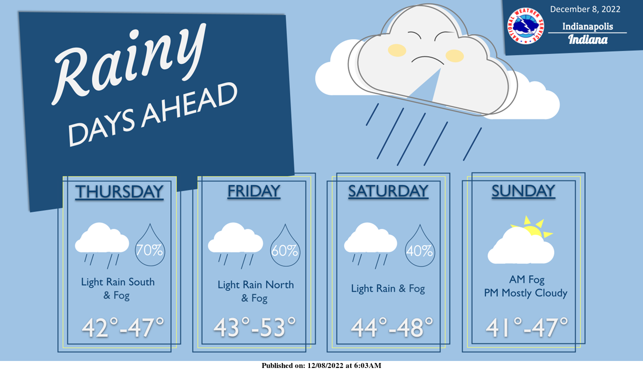
December gloom continues.
Chances for rain, low clouds, and fog stick around into the weekend with a few peaks of sun possible by Sunday afternoon.
Temperatures remain seasonably above average in the 40s to lower 50s.
INDIANAPOLIS 7-DAY EXTENDED FORECAST
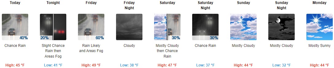
Today: A 40 percent chance of rain, mainly after 11am. Cloudy, with a high near 45. East-northeast wind around 7 mph.
Tonight: A slight chance of rain before 10pm, then scattered sprinkles between 10pm and 1am. Areas of fog after 1am. Otherwise, cloudy, with a low of around 41. East-northeast wind 5 to 7 mph. The chance of precipitation is 20%.
Friday: Rain likely. Areas of fog before 8am. Otherwise, cloudy, with a high near 49. East-southeast wind 6 to 9 mph. The chance of precipitation is 60%. New precipitation amounts of less than a tenth of an inch possible.
Friday Night: Cloudy, with a low around 38. East wind 3 to 6 mph.
Saturday: A 30 percent chance of rain after 1pm. Cloudy, with a high near 47. East wind around 5 mph becoming calm.
Saturday Night: A 30 percent chance of rain before 1am. Cloudy, with a low of around 37.
Sunday: Mostly cloudy, with a high near 44.
Sunday Night: Mostly cloudy, with a low of around 32.
Monday: Mostly sunny, with a high near 44.
Monday Night: A 20 percent chance of snow after 1am. Mostly cloudy, with a low of around 32.
Tuesday: Rain and snow likely. Mostly cloudy, with a high near 49. The chance of precipitation is 60%.
Tuesday Night: Rain. Low around 41. The chance of precipitation is 80%.
Wednesday: A 50 percent chance of rain. Mostly cloudy, with a high near 51.
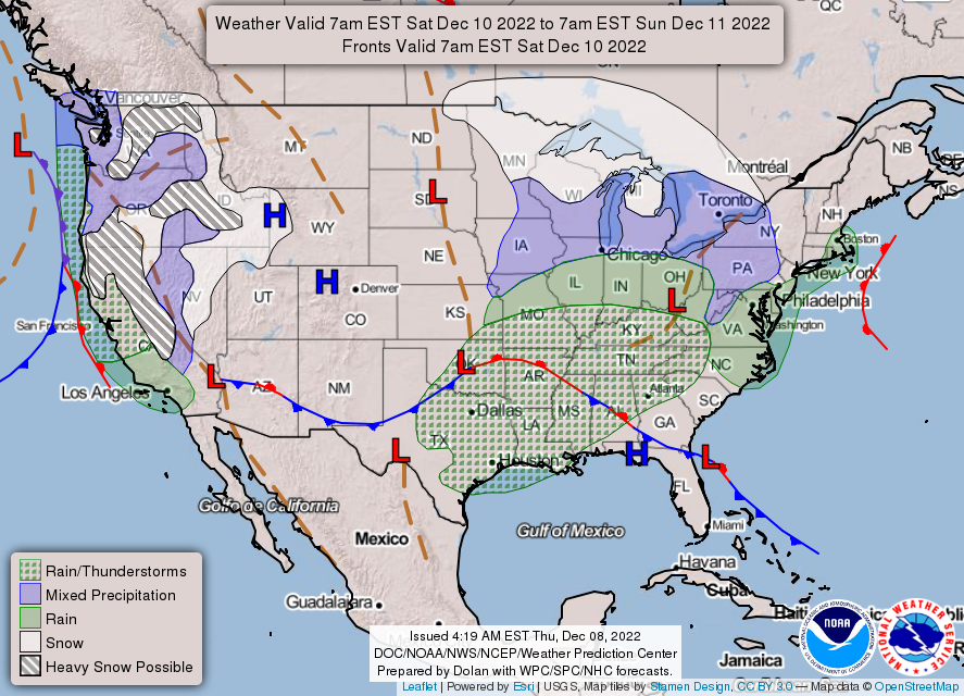
THE UNITED STATES OF AMERICA 3-DAY OUTLOOK
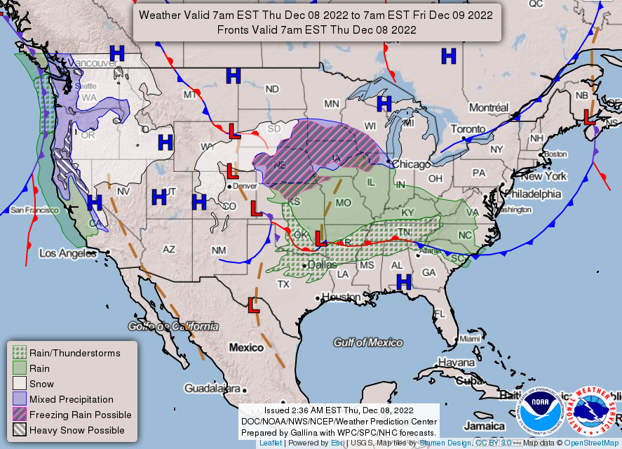
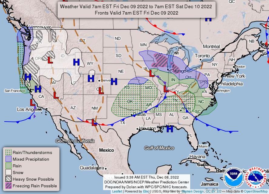
SOURCE: NWS Indianapolis.
Follow NWS Indianapolis on Twitter @NWSIndianapolis for the latest Indianapolis area weather news.