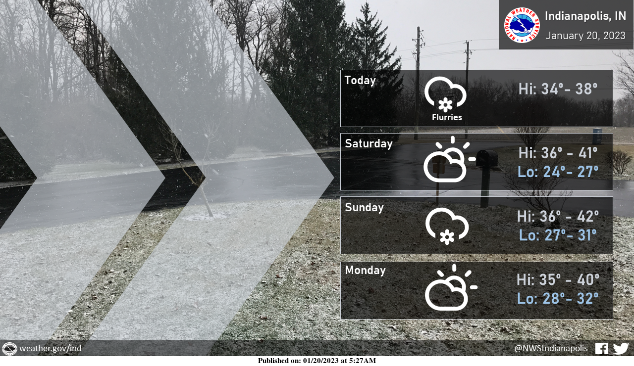
Gusty winds and morning flurries will subside as the day goes on.
Quiet conditions will take hold tonight and continue into Saturday before some light snow arrives Saturday night.
Amounts will generally be light with a dusting to an inch of snow possible by Sunday morning.
INDIANAPOLIS 7-DAY EXTENDED FORECAST
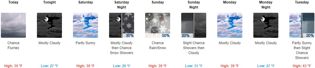
Today: A chance of flurries between noon and 2pm. Cloudy, with a high near 35. West wind 14 to 17 mph, with gusts as high as 26 mph.
Tonight: Mostly cloudy, with a low of around 27. West wind 6 to 13 mph, with gusts as high as 18 mph.
Saturday: Partly sunny, with a high near 39. Southwest wind around 6 mph.
Saturday Night: A 30 percent chance of snow showers after 2am. Increasing clouds, with a low around 29. Southeast wind around 6 mph.
Sunday: A chance of snow showers before 11am, then a chance of rain and snow showers between 11am and 2pm, then a slight chance of rain showers after 2pm. Cloudy, with a high near 39. East-southeast wind 5 to 7 mph becoming northwest in the afternoon. The chance of precipitation is 50%—new precipitation amounts of less than a tenth of an inch possible.
Sunday Night: A 20 percent chance of showers before 8pm. Cloudy, with a low of around 31.
Monday: Mostly cloudy, with a high near 39.
Monday Night: Mostly cloudy, with a low of around 27.
Tuesday: A 20 percent chance of showers after 2pm. Mostly cloudy, with a high near 43.
Tuesday Night: A chance of rain showers before 2am, then rain likely, possibly mixed with snow showers. Cloudy, with a low of around 32. The chance of precipitation is 70%.
Wednesday: Rain and snow showers are likely. Cloudy, with a high near 39. Breezy. The chance of precipitation is 70%.
Wednesday Night: A chance of rain and snow showers. Cloudy, with a low around 23. The chance of precipitation is 30%.
Thursday: Cloudy, with a high near 30.
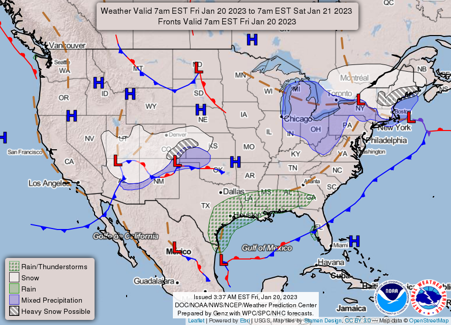
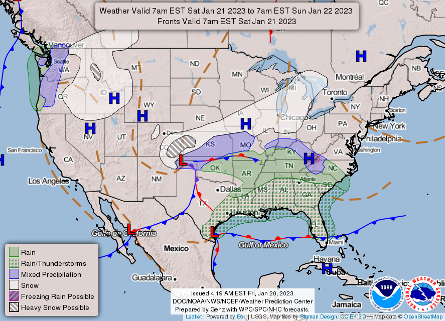
THE UNITED STATES OF AMERICA 3-DAY OUTLOOK

SOURCE: NWS Indianapolis.
Follow NWS Indianapolis on Twitter @NWSIndianapolis for the latest Indianapolis area weather news.