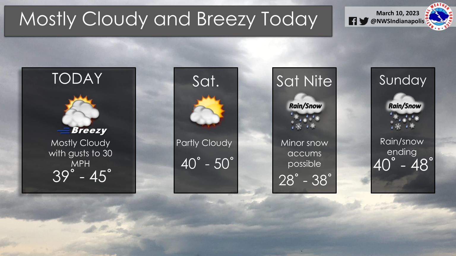
Temperatures will be below normal through the weekend.
Mostly cloudy and breezy conditions are expected today.
Minor snow accumulations are possible Saturday night into early Sunday.
INDIANAPOLIS 7-DAY EXTENDED FORECAST
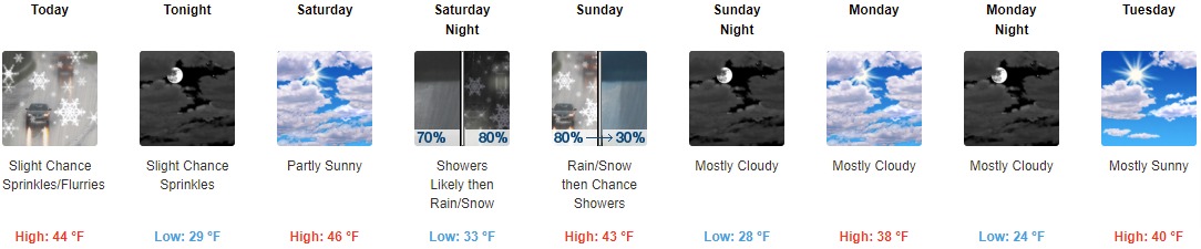
Today: A slight chance of sprinkles and flurries before 3pm, then a slight chance of sprinkles. Cloudy, with a high near 44. West wind around 18 mph, with gusts as high as 28 mph.
Tonight: A slight chance of sprinkles before 8pm. Mostly cloudy, with a low around 29. North wind 8 to 15 mph, with gusts as high as 23 mph.
Saturday: Partly sunny, with a high near 46. North northeast wind 6 to 8 mph becoming east in the afternoon.
Saturday Night: Rain showers likely between 8pm and 2am, then rain and snow showers. Low around 33. East wind 8 to 14 mph, with gusts as high as 21 mph. Chance of precipitation is 80%. New precipitation amounts between a tenth and quarter of an inch possible.
Sunday: Rain and snow showers before 11am, then a chance of rain showers between 11am and 2pm. High near 43. East wind 8 to 11 mph becoming north in the afternoon. Winds could gust as high as 18 mph. Chance of precipitation is 80%. New precipitation amounts of less than a tenth of an inch possible.
Sunday Night: Mostly cloudy, with a low around 28.
Monday: Mostly cloudy, with a high near 38.
Monday Night: Mostly cloudy, with a low around 24.
Tuesday: Mostly sunny, with a high near 40.
Tuesday Night: Mostly clear, with a low around 23.
Wednesday: Mostly sunny, with a high near 49.
Wednesday Night: A 20 percent chance of showers. Mostly cloudy, with a low around 38.
Thursday: A 30 percent chance of showers. Mostly cloudy, with a high near 57.
THE UNITED STATES OF AMERICA 3-DAY OUTLOOK


SOURCE: NWS Indianapolis.
Follow NWS Indianapolis on Twitter @NWSIndianapolis for the latest Indianapolis area weather news.