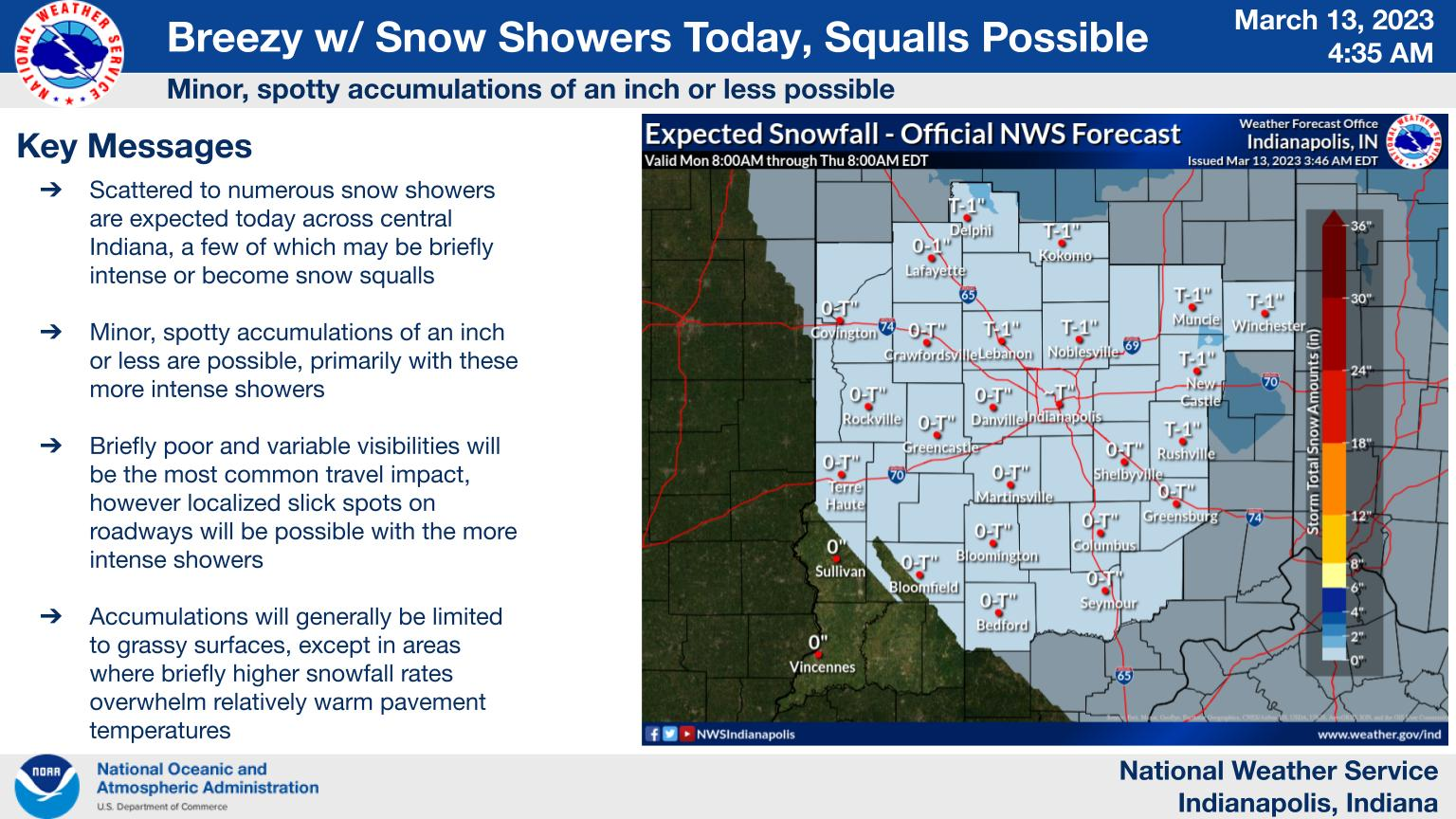
Breezy conditions with 30 MPH gusts, scattered to numerous snow showers, and possibly some snow squalls are expected across the area today.
Minor spotty accumulations of an inch or less are expected, with impacts to travel possible in the most intense snow showers.
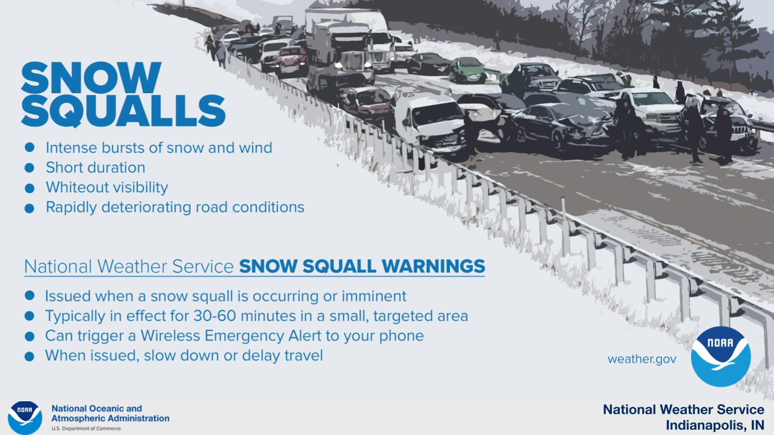
Snow squalls are possible today.
These intense bursts of snow can cause rapid and dangerous deterioration in travel conditions.
Exercise caution if traveling across central Indiana today.
INDIANAPOLIS 7-DAY EXTENDED FORECAST
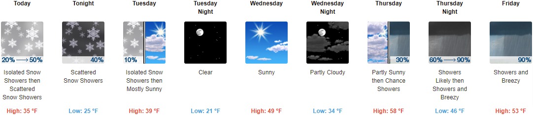
Today: Scattered snow showers, mainly after noon. Cloudy, with a high near 35. West wind 10 to 15 mph, with gusts as high as 23 mph. Chance of precipitation is 50%.
Tonight: Scattered snow showers, mainly before 2am. Mostly cloudy, with a low around 25. Northwest wind 13 to 16 mph, with gusts as high as 25 mph. Chance of precipitation is 40%.
Tuesday: Isolated snow showers before 7am, then scattered flurries between 7am and 8am. Mostly sunny, with a high near 39. Northwest wind 11 to 14 mph, with gusts as high as 21 mph. Chance of precipitation is 10%.
Tuesday Night: Clear, with a low around 21. North northwest wind 5 to 9 mph becoming light north after midnight.
Wednesday: Sunny, with a high near 49. Calm wind becoming south southwest 5 to 7 mph in the afternoon.
Wednesday Night: Partly cloudy, with a low around 34.
Thursday: A 30 percent chance of showers after 3pm. Mostly cloudy, with a high near 58.
Thursday Night: Showers, mainly after 9pm. Low around 46. Breezy. Chance of precipitation is 90%.
Friday: Showers, mainly before 3pm. High near 53. Breezy. Chance of precipitation is 90%.
Friday Night: A 30 percent chance of showers before 9pm. Mostly cloudy, with a low around 27. Blustery.
Saturday: Partly sunny, with a high near 36. Breezy.
Saturday Night: Mostly cloudy, with a low around 23. Breezy.
Sunday: Mostly sunny, with a high near 39.
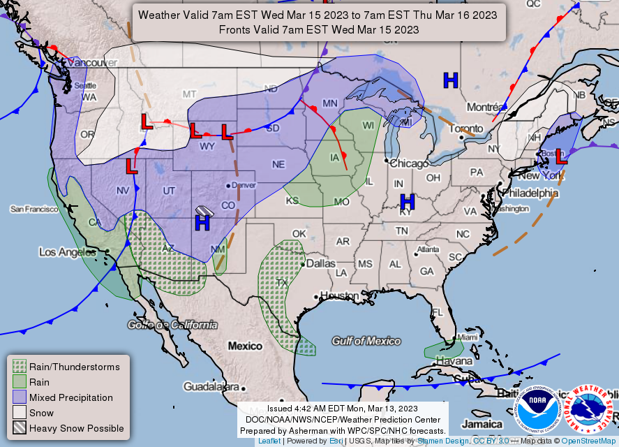
THE UNITED STATES OF AMERICA 3-DAY OUTLOOK


SOURCE: NWS Indianapolis.
Follow NWS Indianapolis on Twitter @NWSIndianapolis for the latest Indianapolis area weather news.