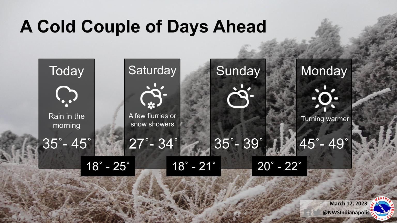
A cold front passing through this morning will bring winter-like temps to Indiana over the weekend.
Highs will run 15 to 25 degrees below normal, and some snow showers are possible Saturday morning as well.
Don't be discouraged, as a warming trend looks to begin by Monday!
INDIANAPOLIS 7-DAY EXTENDED FORECAST
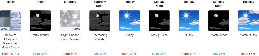
Today: Showers likely, mainly before 10am. Mostly cloudy, with a temperature falling to around 34 by noon. Breezy, with a west northwest wind 16 to 20 mph, with gusts as high as 30 mph. Chance of precipitation is 70%. New precipitation amounts of less than a tenth of an inch possible.
Tonight: Partly cloudy, with a low around 22. West wind around 15 mph, with gusts as high as 23 mph.
Saturday: A 20 percent chance of snow showers before 3pm. Partly sunny, with a high near 31. West wind 16 to 18 mph, with gusts as high as 29 mph.
Saturday Night: Mostly cloudy, then gradually becoming mostly clear, with a low around 20. West northwest wind 14 to 18 mph, with gusts as high as 28 mph.
Sunday: Sunny, with a high near 38. West northwest wind around 10 mph.
Sunday Night: Mostly clear, with a low around 22.
Monday: Sunny, with a high near 47.
Monday Night: Mostly clear, with a low around 27.
Tuesday: Mostly sunny, with a high near 56.
Tuesday Night: Mostly cloudy, with a low around 37.
Wednesday: A 40 percent chance of showers. Partly sunny, with a high near 58.
Wednesday Night: Showers likely. Mostly cloudy, with a low around 47. Chance of precipitation is 60%.
Thursday: Showers likely. Mostly cloudy, with a high near 66. Breezy. Chance of precipitation is 60%.
THE UNITED STATES OF AMERICA 3-DAY OUTLOOK


SOURCE: NWS Indianapolis.
Follow NWS Indianapolis on Twitter @NWSIndianapolis for the latest Indianapolis area weather news.