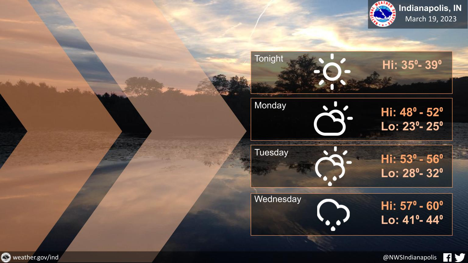
Cold weather will persist today, but a warming trend begins tomorrow!
Expect high temps to climb into the 50s early this week.
Unfortunately, with the warmth comes the rain, and scattered showers are likely beginning Tuesday evening.
INDIANAPOLIS 7-DAY EXTENDED FORECAST
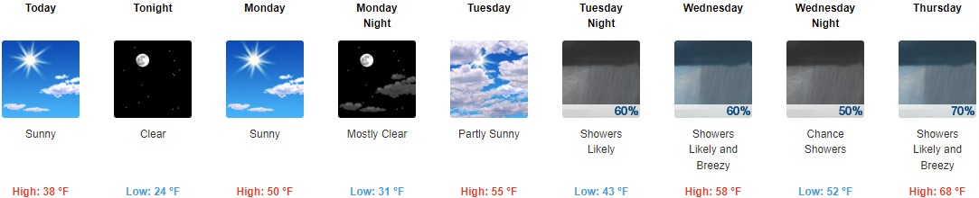
Today: Sunny, with a high near 38. West wind 8 to 10 mph.
Tonight: Clear, with a low around 24. Southwest wind around 7 mph.
Monday: Sunny, with a high near 50. South southwest wind 10 to 15 mph, with gusts as high as 23 mph.
Monday Night: Mostly clear, with a low around 31. South southwest wind 11 to 14 mph, with gusts as high as 22 mph.
Tuesday: Partly sunny, with a high near 55. South wind 10 to 14 mph, with gusts as high as 20 mph.
Tuesday Night: Showers likely. Cloudy, with a low around 43. Chance of precipitation is 60%. New precipitation amounts of less than a tenth of an inch possible.
Wednesday: Showers likely, mainly before 2pm. Mostly cloudy, with a high near 58. Breezy. Chance of precipitation is 60%.
Wednesday Night: A 50 percent chance of showers. Mostly cloudy, with a low around 52.
Thursday: Showers likely, with thunderstorms also possible after 2pm. Mostly cloudy, with a high near 68. Breezy. Chance of precipitation is 70%.
Thursday Night: Showers and possibly a thunderstorm. Low around 47. Breezy. Chance of precipitation is 80%.
Friday: Showers likely. Mostly cloudy, with a high near 56. Chance of precipitation is 60%.
Friday Night: A 40 percent chance of showers. Mostly cloudy, with a low around 37.
Saturday: A 10 percent chance of showers. Mostly sunny, with a high near 56.
THE UNITED STATES OF AMERICA 3-DAY OUTLOOK


SOURCE: NWS Indianapolis.
Follow NWS Indianapolis on Twitter @NWSIndianapolis for the latest Indianapolis area weather news.