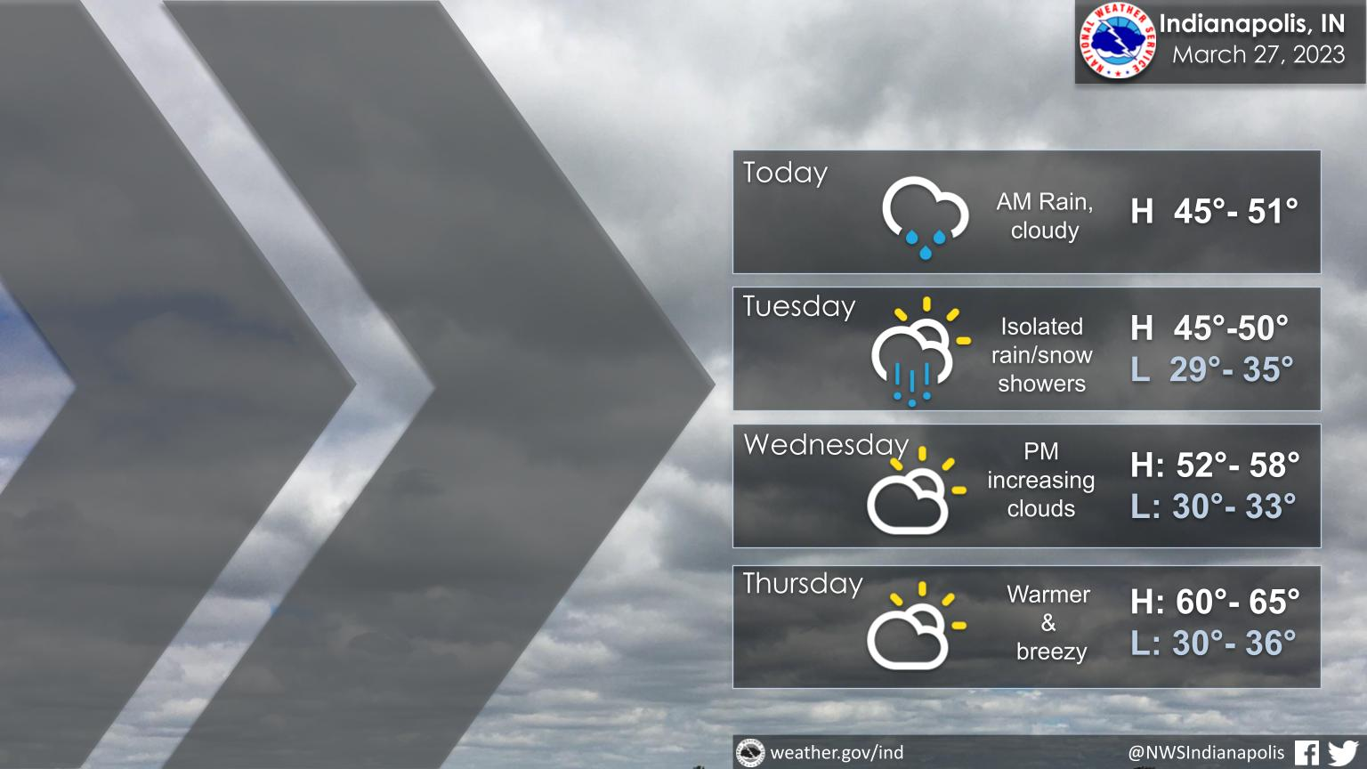
Cool and wet weather returns to Central Indiana today and tomorrow.
Much warmer air arrives mid to late week with the next chance of rain and storms on Friday.
INDIANAPOLIS 7-DAY EXTENDED FORECAST
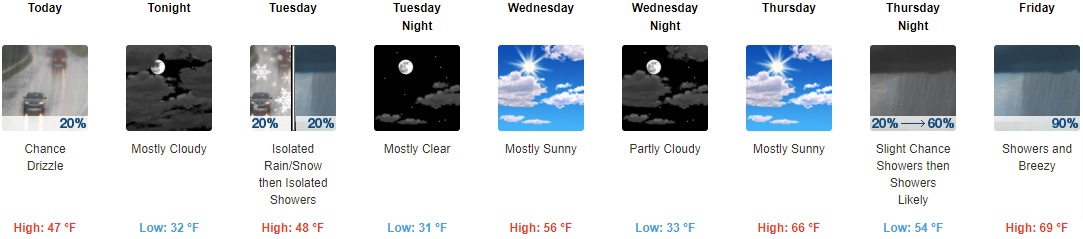
Today: A chance of drizzle with a slight chance of rain before 9am, then a chance of drizzle between 9am and 2pm. Cloudy, with a high near 47. Northwest wind 7 to 9 mph. Chance of precipitation is 20%.
Tonight: Mostly cloudy, with a low around 32. North wind around 7 mph.
Tuesday: A slight chance of rain and snow showers before 11am, then a slight chance of rain showers. Mostly cloudy, with a high near 48. North wind 6 to 8 mph. Chance of precipitation is 20%.
Tuesday Night: Mostly clear, with a low around 31. North northwest wind around 6 mph becoming light and variable after midnight.
Wednesday: Mostly sunny, with a high near 56. Southwest wind 6 to 15 mph, with gusts as high as 22 mph.
Wednesday Night: Partly cloudy, with a low around 33.
Thursday: Mostly sunny, with a high near 66.
Thursday Night: A slight chance of showers, then showers likely and possibly a thunderstorm after 2am. Mostly cloudy, with a low around 54. Chance of precipitation is 60%.
Friday: Showers and possibly a thunderstorm. High near 69. Breezy. Chance of precipitation is 90%.
Friday Night: Showers and possibly a thunderstorm before 2am, then a chance of showers and thunderstorms after 2am. Low around 45. Breezy. Chance of precipitation is 90%.
Saturday: A 30 percent chance of showers and thunderstorms. Partly sunny, with a high near 56. Breezy.
Saturday Night: Partly cloudy, with a low around 31.
Sunday: Sunny, with a high near 59.
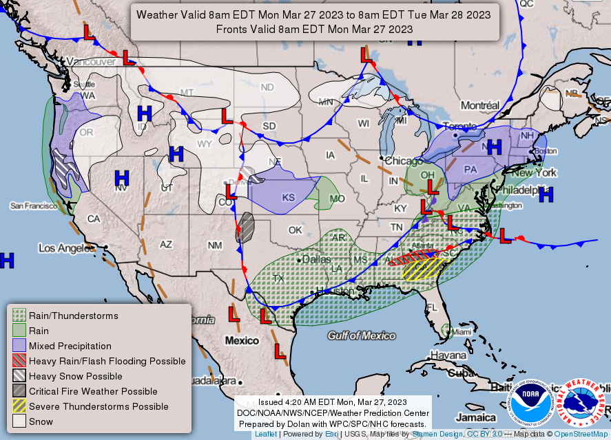
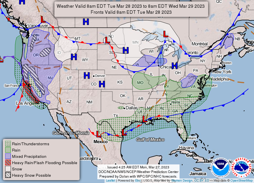
THE UNITED STATES OF AMERICA 3-DAY OUTLOOK

SOURCE: NWS Indianapolis.
Follow NWS Indianapolis on Twitter @NWSIndianapolis for the latest Indianapolis area weather news.