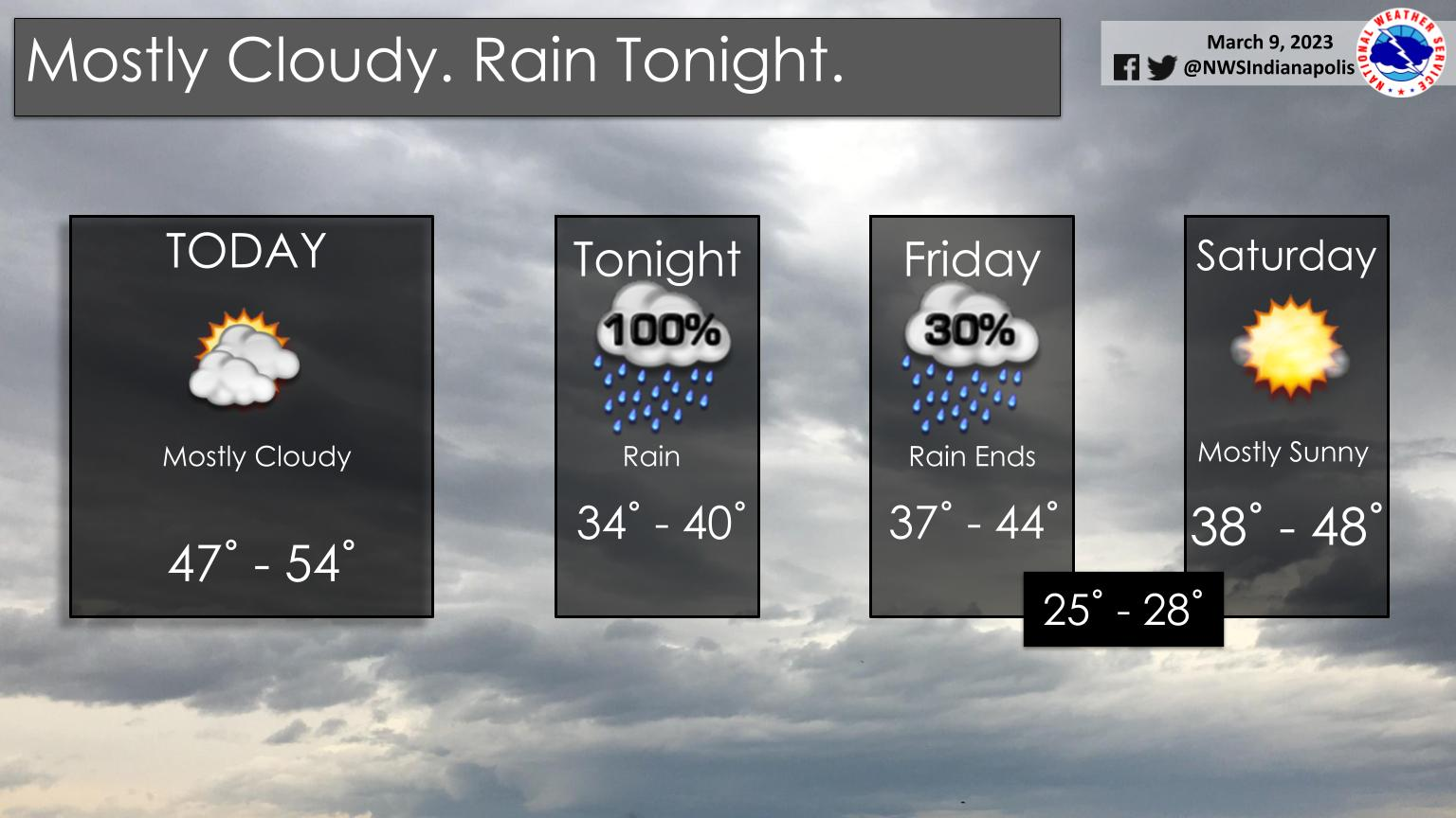
Expect mostly cloudy skies today with rain arriving tonight.
Highs today will reach the upper 40s and low 50s.
Cooler air and a wintry mix arrives Saturday night and Sunday.
Temperatures will be running near to below average through the weekend.
INDIANAPOLIS 7-DAY EXTENDED FORECAST
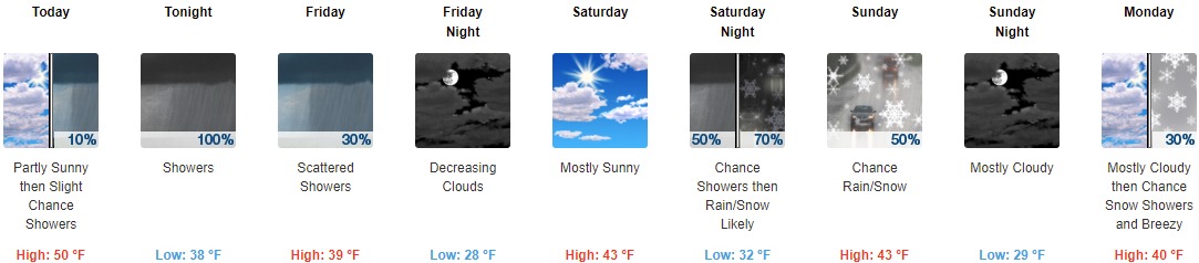
Today: A 10 percent chance of showers after 5pm. Mostly cloudy, with a high near 50. East wind around 11 mph, with gusts as high as 18 mph.
Tonight: Showers, mainly before 4am. Low around 38. East wind 8 to 13 mph becoming west southwest after midnight. Winds could gust as high as 20 mph. Chance of precipitation is 100%. New precipitation amounts between a tenth and quarter of an inch possible.
Friday: Scattered showers, mainly before 7am. Cloudy, with a steady temperature around 39. West wind 13 to 16 mph, with gusts as high as 25 mph. Chance of precipitation is 30%.
Friday Night: Cloudy, then gradually becoming partly cloudy, with a low around 28. North wind 9 to 14 mph, with gusts as high as 21 mph.
Saturday: Mostly sunny, with a high near 43. East wind 6 to 8 mph.
Saturday Night: A chance of rain showers before 1am, then rain and snow showers likely. Mostly cloudy, with a low around 32. Chance of precipitation is 70%. New precipitation amounts between a tenth and quarter of an inch possible.
Sunday: A chance of rain and snow showers before 1pm, then a chance of rain showers. Mostly cloudy, with a high near 43. Chance of precipitation is 50%.
Sunday Night: Mostly cloudy, with a low around 29.
Monday: A 30 percent chance of snow showers after 1pm. Mostly cloudy, with a high near 40. Breezy.
Monday Night: Mostly cloudy, with a low around 26. Blustery.
Tuesday: Mostly sunny, with a high near 40.
Tuesday Night: Mostly clear, with a low around 25.
Wednesday: Mostly sunny, with a high near 49.
THE UNITED STATES OF AMERICA 3-DAY OUTLOOK


SOURCE: NWS Indianapolis.
Follow NWS Indianapolis on Twitter @NWSIndianapolis for the latest Indianapolis area weather news.