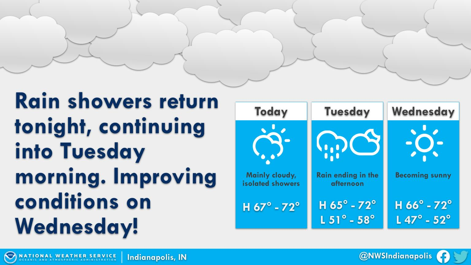
Rainy weather will take a break this afternoon before arriving once again overnight.
The best chance of rain will be after midnight tonight into tomorrow morning, before dry weather finally wins out tomorrow afternoon.
Sunny skies return by Wednesday!
INDIANAPOLIS 7-DAY EXTENDED FORECAST
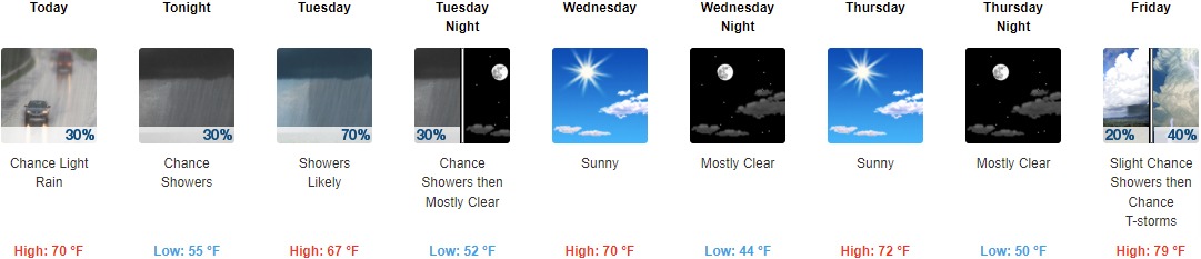
Today: A chance of light rain with a slight chance of showers before 1pm, then a slight chance of showers after 3pm. Mostly cloudy, with a high near 70. Northeast wind 6 to 10 mph. Chance of precipitation is 30%.
Tonight: A slight chance of showers before 8pm, then a chance of showers after 2am. Increasing clouds, with a low around 55. Light and variable wind. Chance of precipitation is 30%.
Tuesday: Showers likely, mainly between 8am and 2pm. Cloudy, with a high near 67. Calm wind becoming north 5 to 8 mph in the morning. Chance of precipitation is 70%. New precipitation amounts between a tenth and quarter of an inch possible.
Tuesday Night: A 30 percent chance of showers before 8pm. Partly cloudy, with a low around 52. West northwest wind 7 to 9 mph.
Wednesday: Sunny, with a high near 70. Northeast wind around 10 mph.
Wednesday Night: Mostly clear, with a low around 44.
Thursday: Sunny, with a high near 72.
Thursday Night: Mostly clear, with a low around 50.
Friday: A slight chance of showers, then a chance of showers and thunderstorms after 2pm. Mostly sunny, with a high near 79. Chance of precipitation is 40%.
Friday Night: A chance of showers and thunderstorms. Mostly cloudy, with a low around 56. Chance of precipitation is 50%.
Saturday: A 30 percent chance of showers. Partly sunny, with a high near 74.
Saturday Night: A 20 percent chance of showers. Partly cloudy, with a low around 51.
Sunday: Mostly sunny, with a high near 76.
THE UNITED STATES OF AMERICA 3-DAY OUTLOOK


SOURCE: NWS Indianapolis.
Follow NWS Indianapolis on Twitter @NWSIndianapolis for the latest Indianapolis area weather news.