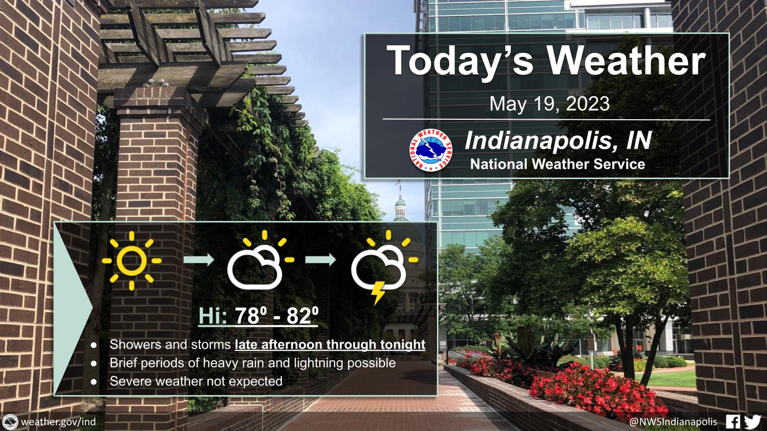
A dry start to the day, then showers and thunderstorms move in the late afternoon through the evening hours.
Expect highs in the upper 70s to low 80s.
INDIANAPOLIS 7-DAY EXTENDED FORECAST
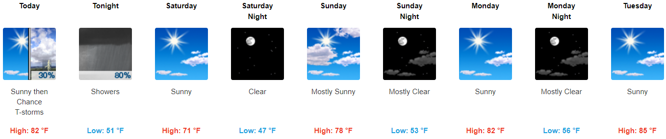
Today: A slight chance of showers between 4pm and 5pm, then a chance of showers and thunderstorms after 5pm. Mostly sunny, with a high near 82. Southwest wind around 10 mph. Chance of precipitation is 30%.
Tonight: Showers and thunderstorms, mainly before 2am. Low around 51. West northwest wind 10 to 13 mph becoming north after midnight. Winds could gust as high as 18 mph. Chance of precipitation is 80%. New rainfall amounts between a tenth and a quarter of an inch, except higher amounts possible in thunderstorms.
Saturday: Sunny, with a high near 71. North wind around 11 mph.
Saturday Night: Clear, with a low around 47. North wind 7 to 9 mph.
Sunday: Mostly sunny, with a high near 78. Northeast wind around 6 mph.
Sunday Night: Mostly clear, with a low around 53.
Monday: Sunny, with a high near 82.
Monday Night: Mostly clear, with a low around 56.
Tuesday: Sunny, with a high near 85.
Tuesday Night: Mostly clear, with a low around 58.
Wednesday: Sunny, with a high near 87.
Wednesday Night: Partly cloudy, with a low around 61.
Thursday: Mostly sunny, with a high near 88.
THE UNITED STATES OF AMERICA 3-DAY OUTLOOK


SOURCE: NWS Indianapolis.
Follow NWS Indianapolis on Twitter @NWSIndianapolis for the latest Indianapolis area weather news.