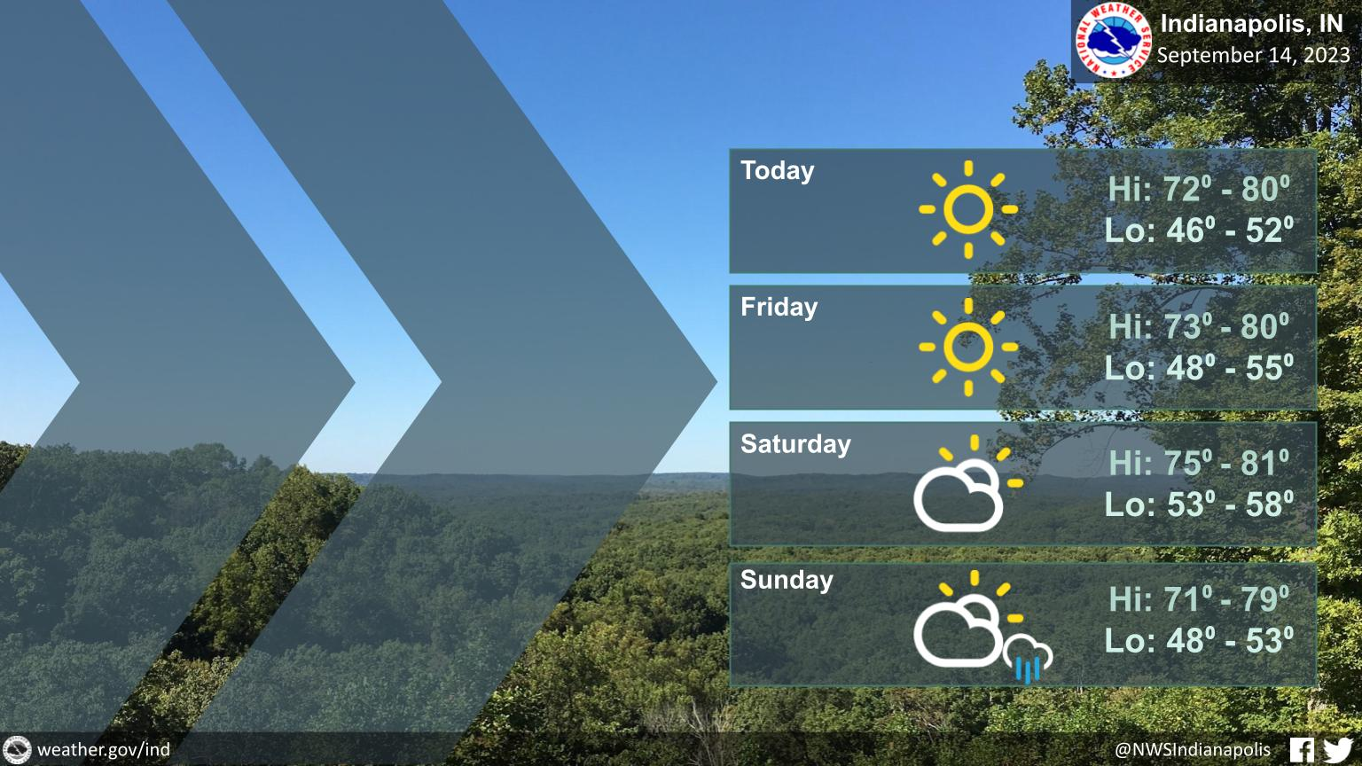
Warm and dry conditions will continue over the next few days with highs mainly in the 70s.
Nights will be cool, ranging generally from the mid 40s to mid 50s.
A cold front will move through Saturday night and Sunday with a few showers, but most locations will remain dry.
INDIANAPOLIS DAILY CLIMATE DATA
INDIANAPOLIS 7-DAY EXTENDED FORECAST
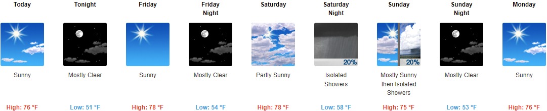
Today: Sunny, with a high near 76. East northeast wind around 6 mph.
Tonight: Mostly clear, with a low around 51. East northeast wind around 6 mph.
Friday: Sunny, with a high near 78. East wind 3 to 6 mph.
Friday Night: Mostly clear, with a low around 54. East wind 3 to 5 mph.
Saturday: Partly sunny, with a high near 78. Light and variable wind becoming southwest around 5 mph in the afternoon.
Saturday Night: Isolated showers. Mostly cloudy, with a low around 58. Chance of precipitation is 20%.
Sunday: Isolated showers after 2pm. Mostly sunny, with a high near 75. Chance of precipitation is 20%.
Sunday Night: Mostly clear, with a low around 53.
Monday: Sunny, with a high near 76.
Monday Night: Mostly clear, with a low around 54.
Tuesday: Sunny, with a high near 81.
Tuesday Night: Mostly clear, with a low around 58.
Wednesday: Sunny, with a high near 83.
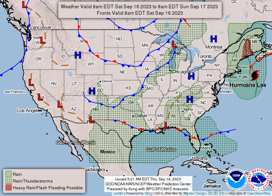
THE UNITED STATES OF AMERICA 3-DAY OUTLOOK

SOURCE: NWS Indianapolis.
Follow NWS Indianapolis on Twitter @NWSIndianapolis for the latest Indianapolis area weather news.